Nakkila geodata
Nakkila (Satakunta) is a seat of a third-order administrative division; located in Finland in Europe/Helsinki (GMT+3) time zone. With population of 5,792 people, there are 181 cities with bigger population in this country. Compared to other cities in Finland, 59.2% of cities are located further ↑North; 90.6% of cities are located further →East and 81.4% of cities have higher elevation than Nakkila. Note1


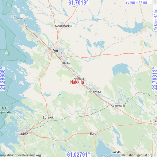
Nakkila GPS coordinates[2]
61° 22' 0.012" North, 22° 0' 0" East
| Map corner | latitude | longitude |
|---|---|---|
| Upper-left | 61.7018°, | 21.29688° |
| Center: | 61.36667°, | 22° |
| Lower-right: | 61.02791°, | 22.70313° |
| Map W x H: | 74.9×74.9 km | = 46.5×46.5mi |
| max Lat: | 69.90864° ⇑59.2% North |
| Nakkila: | 61.36667° |
| min Lat: | ⇓40.8% South 59.83333° |
| min Long | Nakkila | max Long |
| 21.2° | 22° | 30.93276° |
| W 9.4%⇐ | ⇒90.6% E |
Elevation
Elevation of Nakkila is 18 m = 59 ft, and this is 59.1 m = 194 ft below average elevation for this country.
| Max E: |
299 m = 981 ft | 81.4% |
| Avg. | 77.1 m = 253 ft | |
| Nakkila | 18 m = 59 ft | |
Min E: |
1 m = 3 ft | 18.6% |
See also: Finland elevation on elevation.city.
Geographical zone
Nakkila is located in North temperate zone (between Tropic of Cancer and the Arctic Circle). Distance of this North polar circle is 577.8 km =359 mi to North.| Distance of | km | miles | from Nakkila |
|---|---|---|---|
| North Pole | 3183.7 | 1978.3 | to North |
| Arctic Circle | 577.8 | 359 | to North |
| Tropic Cancer | 4217.4 | 2620.6 | to South |
| Equator | 6823.3 | 4239.8 | to South |


Nearby cities:
15 places around Nakkila: (largest is in red/bold)
• Eura
26.9 km =16.7 mi,  164°
164°
• Eurajoki
23.4 km =14.5 mi,  217°
217°
• Harjavalta
9 km =5.6 mi,  128°
128°
• Kiikoinen
32.2 km =20 mi,  72°
72°
• Kiukainen
17.3 km =10.7 mi,  165°
165°
• Kokemäki
22.6 km =14 mi,  122°
122°
• Kullaa
14.3 km =8.9 mi,  36°
36°
• Köyliö
32.1 km =19.9 mi,  148°
148°
• Lappi
31 km =19.3 mi,  196°
196°
• Luvia
20 km =12.4 mi,  269°
269°
• Längelmäki
31.9 km =19.8 mi,  9°
9°
• Noormarkku
26.1 km =16.2 mi,  344°
344°
• Pomarkku
36.3 km =22.6 mi,  0°
0°
• Pori
17.4 km =10.8 mi,  318°
318°
• Ulvila
9.7 km =6 mi, 315°
Sources, notices
• [Note1] Compared only with cities in Finland existing in our database
• [Src1] Map data: © OpenStreetMap contributors (CC-BY-SA)
• [Src2] Other city data from geonames.org with taken over terms of usage.
• [Src3] Geographical zone / Annual Mean Temperature by Robert A. Rohde @ Wikipedia
