Lieksa geodata
Lieksa (North Karelia) is a seat of a third-order administrative division; located in Finland in Europe/Helsinki (GMT+3) time zone. With population of 13,703 people, there are 81 cities with bigger population in this country. Compared to other cities in Finland, 77.1% of cities are located further ↓South; 98.7% of cities are located further ←West and 60% of cities have lower elevation than Lieksa. Note1


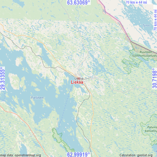
Lieksa GPS coordinates[2]
63° 19' 0.012" North, 30° 1' 0.012" East
| Map corner | latitude | longitude |
|---|---|---|
| Upper-left | 63.63069°, | 29.31355° |
| Center: | 63.31667°, | 30.01667° |
| Lower-right: | 62.99919°, | 30.7198° |
| Map W x H: | 70.2×70.2 km | = 43.6×43.6mi |
| max Lat: | 69.90864° ⇑22.9% North |
| Lieksa: | 63.31667° |
| min Lat: | ⇓77.1% South 59.83333° |
| min Long | Lieksa | max Long |
| 21.2° | 30.01667° | 30.93276° |
| W 98.7%⇐ | ⇒1.3% E |
Elevation
Elevation of Lieksa is 95 m = 312 ft, and this is 17.9 m = 59 ft above average elevation for this country.
| Max E: |
299 m = 981 ft | 40% |
| Lieksa | 95 m 312 ft | |
| Avg. | 77.1 m = 253 ft | |
Min E: |
1 m = 3 ft | 60% |
See also: Finland elevation on elevation.city.
Geographical zone
Lieksa is located in North temperate zone (between Tropic of Cancer and the Arctic Circle). Distance of this North polar circle is 361 km =224.3 mi to North.| Distance of | km | miles | from Lieksa |
|---|---|---|---|
| North Pole | 2966.9 | 1843.5 | to North |
| Arctic Circle | 361 | 224.3 | to North |
| Tropic Cancer | 4434.2 | 2755.3 | to South |
| Equator | 7040.2 | 4374.6 | to South |


Nearby cities:
15 places around Lieksa: (largest is in red/bold)
• Eno
57.3 km =35.6 mi,  173°
173°
• Ilomantsi
85.3 km =53 mi,  147°
147°
• Joensuu
80.6 km =50.1 mi,  189°
189°
• Juankoski
88.1 km =54.7 mi,  251°
251°
• Juuka
39.4 km =24.5 mi,  256°
256°
• Kaavi
84.7 km =52.6 mi,  244°
244°
• Kiihtelysvaara
92.1 km =57.2 mi, 172°
• Kontiolahti
62.5 km =38.8 mi, 187°
• Kuhmo
94.1 km =58.5 mi,  344°
344°
• Liperi
93.1 km =57.8 mi,  200°
200°
• Nurmes
50.3 km =31.3 mi,  299°
299°
• Outokumpu
82.8 km =51.4 mi,  217°
217°
• Polvijärvi
61.3 km =38.1 mi,  212°
212°
• Rautavaara
87.4 km =54.3 mi,  282°
282°
• Valtimo
71.8 km =44.6 mi, 302°
Sources, notices
• [Note1] Compared only with cities in Finland existing in our database
• [Src1] Map data: © OpenStreetMap contributors (CC-BY-SA)
• [Src2] Other city data from geonames.org with taken over terms of usage.
• [Src3] Geographical zone / Annual Mean Temperature by Robert A. Rohde @ Wikipedia
