Ilomantsi geodata
Ilomantsi (North Karelia) is a seat of a third-order administrative division; located in Finland in Europe/Helsinki (GMT+3) time zone. With population of 6,408 people, there are 168 cities with bigger population in this country. Compared to other cities in Finland, 65% of cities are located further ↓South; 100% of cities are located further ←West and 92.5% of cities have lower elevation than Ilomantsi. Note1


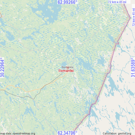
Ilomantsi GPS coordinates[2]
62° 40' 17.832" North, 30° 55' 57.936" East
| Map corner | latitude | longitude |
|---|---|---|
| Upper-left | 62.99266°, | 30.22964° |
| Center: | 62.67162°, | 30.93276° |
| Lower-right: | 62.34706°, | 31.63589° |
| Map W x H: | 71.8×71.8 km | = 44.6×44.6mi |
| max Lat: | 69.90864° ⇑35% North |
| Ilomantsi: | 62.67162° |
| min Lat: | ⇓65% South 59.83333° |
| min Long | Ilomantsi | max Long |
| 21.2° | 30.93276° | 30.93276° |
| W 100%⇐ | ⇒0% E |
Elevation
Elevation of Ilomantsi is 149 m = 489 ft, and this is 71.9 m = 236 ft above average elevation for this country.
| Max E: |
299 m = 981 ft | 7.5% |
| Ilomantsi | 149 m 489 ft | |
| Avg. | 77.1 m = 253 ft | |
Min E: |
1 m = 3 ft | 92.5% |
See also: Finland elevation on elevation.city.
Geographical zone
Ilomantsi is located in North temperate zone (between Tropic of Cancer and the Arctic Circle). Distance of this North polar circle is 432.7 km =268.9 mi to North.| Distance of | km | miles | from Ilomantsi |
|---|---|---|---|
| North Pole | 3038.6 | 1888.1 | to North |
| Arctic Circle | 432.7 | 268.9 | to North |
| Tropic Cancer | 4362.5 | 2710.7 | to South |
| Equator | 6968.4 | 4330 | to South |


Nearby cities:
15 places around Ilomantsi: (largest is in red/bold)
• Eno
42.3 km =26.3 mi,  290°
290°
• Joensuu
60.3 km =37.5 mi,  262°
262°
• Kesälahti
103.1 km =64.1 mi,  213°
213°
• Kiihtelysvaara
40 km =24.9 mi,  240°
240°
• Kitee
75.3 km =46.8 mi, 212°
• Kontiolahti
56.2 km =34.9 mi,  280°
280°
• Lieksa
85.3 km =53 mi,  327°
327°
• Liperi
81.6 km =50.7 mi, 259°
• Outokumpu
97.9 km =60.8 mi,  273°
273°
• Polvijärvi
82.1 km =51 mi, 283°
• Pyhäselkä
56.2 km =34.9 mi, 241°
• Rääkkylä
78.3 km =48.7 mi, 239°
• Savonranta
104.4 km =64.9 mi, 238°
• Tohmajärvi
61.2 km =38 mi, 207°
• Tuupovaara
26.1 km =16.2 mi,  216°
216°
Sources, notices
• [Note1] Compared only with cities in Finland existing in our database
• [Src1] Map data: © OpenStreetMap contributors (CC-BY-SA)
• [Src2] Other city data from geonames.org with taken over terms of usage.
• [Src3] Geographical zone / Annual Mean Temperature by Robert A. Rohde @ Wikipedia
