Kestilä geodata
Kestilä (Northern Ostrobothnia) is a populated place; located in Finland in Europe/Helsinki (GMT+3) time zone. With population of 1,576 people, there are 386 cities with bigger population in this country. Compared to other cities in Finland, 88.2% of cities are located further ↓South; 73.3% of cities are located further ←West and 68.2% of cities have lower elevation than Kestilä. Note1
Administrative division(s):
- Level 1: Northern Ostrobothnia
- Level 2: Haapavesi-Siikalatva
- Level 3: Siikalatva


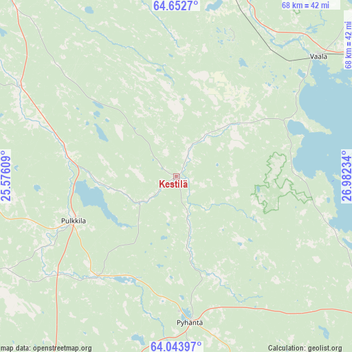
Kestilä GPS coordinates[2]
64° 21' 0.072" North, 26° 16' 45.156" East
| Map corner | latitude | longitude |
|---|---|---|
| Upper-left | 64.6527°, | 25.57609° |
| Center: | 64.35002°, | 26.27921° |
| Lower-right: | 64.04397°, | 26.98234° |
| Map W x H: | 67.7×67.7 km | = 42.1×42.1mi |
| max Lat: | 69.90864° ⇑11.8% North |
| Kestilä: | 64.35002° |
| min Lat: | ⇓88.2% South 59.83333° |
| min Long | Kestilä | max Long |
| 21.2° | 26.27921° | 30.93276° |
| W 73.3%⇐ | ⇒26.7% E |
Elevation
Elevation of Kestilä is 104 m = 341 ft, and this is 26.9 m = 88 ft above average elevation for this country.
| Max E: |
299 m = 981 ft | 31.8% |
| Kestilä | 104 m 341 ft | |
| Avg. | 77.1 m = 253 ft | |
Min E: |
1 m = 3 ft | 68.2% |
See also: Finland elevation on elevation.city.
Geographical zone
Kestilä is located in North temperate zone (between Tropic of Cancer and the Arctic Circle). Distance of this North polar circle is 246.1 km =152.9 mi to North.| Distance of | km | miles | from Kestilä |
|---|---|---|---|
| North Pole | 2852 | 1772.2 | to North |
| Arctic Circle | 246.1 | 152.9 | to North |
| Tropic Cancer | 4549.1 | 2826.7 | to South |
| Equator | 7155.1 | 4446 | to South |


Nearby cities:
15 places around Kestilä: (largest is in red/bold)
• Haapavesi
50.2 km =31.2 mi,  241°
241°
• Kärsämäki
49.3 km =30.6 mi,  210°
210°
• Liminka
65.7 km =40.8 mi,  321°
321°
• Muhos
47.1 km =29.3 mi,  349°
349°
• Muhos
52.7 km =32.7 mi,  344°
344°
• Piippola
25.4 km =15.8 mi,  216°
216°
• Pulkkila
21.9 km =13.6 mi,  245°
245°
• Pyhäntä
27.9 km =17.3 mi,  176°
176°
• Rantsila
34.2 km =21.3 mi,  300°
300°
• Ruukki
66.5 km =41.3 mi, 301°
• Tyrnävä
55 km =34.2 mi,  326°
326°
• Utajärvi
44.8 km =27.8 mi,  6°
6°
• Vaala
35.9 km =22.3 mi,  47°
47°
• Vihanti
63.6 km =39.5 mi,  283°
283°
• Vuolijoki
39.1 km =24.3 mi,  117°
117°
Sources, notices
• [Note1] Compared only with cities in Finland existing in our database
• [Src1] Map data: © OpenStreetMap contributors (CC-BY-SA)
• [Src2] Other city data from geonames.org with taken over terms of usage.
• [Src3] Geographical zone / Annual Mean Temperature by Robert A. Rohde @ Wikipedia
