Waziers geodata
Waziers (Hauts-de-France) is a populated place; located in France in Europe/Paris (GMT+2) time zone. With population of 7,852 people, there are 1233 cities with bigger population in this country. Compared to other cities in France, 96.4% of cities are located further ↓South; 59.5% of cities are located further ←West and 93.1% of cities have higher elevation than Waziers. Note1
Administrative division(s):
- Level 1: Hauts-de-France
- Level 2: Nord
- Level 3: Arrondissement de Douai
- Level 4: Waziers


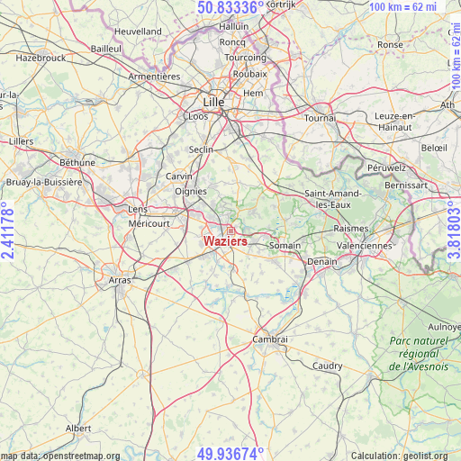
Waziers GPS coordinates[2]
50° 23' 13.812" North, 3° 6' 53.64" East
| Map corner | latitude | longitude |
|---|---|---|
| Upper-left | 50.83336°, | 2.41178° |
| Center: | 50.38717°, | 3.1149° |
| Lower-right: | 49.93674°, | 3.81803° |
| Map W x H: | 99.7×99.7 km | = 62×62mi |
| max Lat: | 51.07786° ⇑3.6% North |
| Waziers: | 50.38717° |
| min Lat: | ⇓96.4% South 41.3874° |
| min Long | Waziers | max Long |
| -5.08615° | 3.1149° | 9.52242° |
| W 59.5%⇐ | ⇒40.5% E |
Elevation
Elevation of Waziers is 22 m = 72 ft, and this is 171.7 m = 563 ft below average elevation for this country.
| Max E: |
2333 m = 7654 ft | 93.1% |
| Avg. | 193.7 m = 635 ft | |
| Waziers | 22 m = 72 ft | |
Min E: |
-1 m = -3 ft | 6.9% |
See also: France elevation on elevation.city.
Geographical zone
Waziers is located in North temperate zone (between Tropic of Cancer and the Arctic Circle). Distance of this North polar circle is 1798.6 km =1117.6 mi to North.| Distance of | km | miles | from Waziers |
|---|---|---|---|
| North Pole | 4404.5 | 2736.8 | to North |
| Arctic Circle | 1798.6 | 1117.6 | to North |
| Tropic Cancer | 2996.6 | 1862 | to South |
| Equator | 5602.5 | 3481.2 | to South |


Nearby cities:
15 places around Waziers: (largest is in red/bold)
• Anhiers
3.6 km =2.2 mi,  51°
51°
• Auby
5.3 km =3.3 mi,  305°
305°
• Cuincy
4.5 km =2.8 mi,  258°
258°
• Dechy
4.1 km =2.5 mi,  178°
178°
• Douai
3.1 km =1.9 mi,  234°
234°
• Flers-en-Escrebieux
4 km =2.5 mi,  287°
287°
• Guesnain
4.8 km =3 mi,  148°
148°
• Lallaing
3.9 km =2.4 mi,  85°
85°
• Lambres-lez-Douai
5.4 km =3.4 mi,  219°
219°
• Lauwin-Planque
5 km =3.1 mi,  273°
273°
• Loffre
5.2 km =3.2 mi,  130°
130°
• Montigny-en-Ostrevent
5.4 km =3.4 mi,  115°
115°
• Roost-Warendin
3.6 km =2.2 mi,  347°
347°
• Râches
3.7 km =2.3 mi,  24°
24°
• Sin-le-Noble
3.1 km =1.9 mi,  157°
157°
Sources, notices
• [Note1] Compared only with cities in France existing in our database
• [Src1] Map data: © OpenStreetMap contributors (CC-BY-SA)
• [Src2] Other city data from geonames.org with taken over terms of usage.
• [Src3] Geographical zone / Annual Mean Temperature by Robert A. Rohde @ Wikipedia
