Voujeaucourt geodata
Voujeaucourt (Bourgogne-Franche-Comté) is a populated place; located in France in Europe/Paris (GMT+2) time zone. With population of 3,346 people, there are 2918 cities with bigger population in this country. Compared to other cities in France, 50.8% of cities are located further ↓South; 93.5% of cities are located further ←West and 82.5% of cities have lower elevation than Voujeaucourt. Note1
Administrative division(s):
- Level 1: Bourgogne-Franche-Comté
- Level 2: Doubs
- Level 3: Arrondissement de Montbéliard
- Level 4: Voujeaucourt


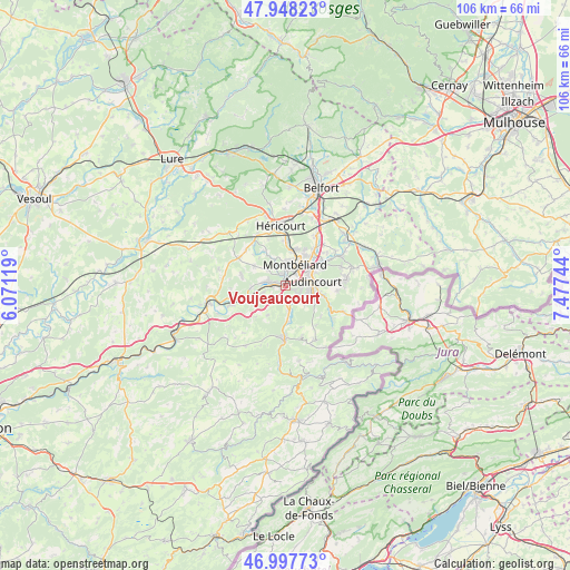
Voujeaucourt GPS coordinates[2]
47° 28' 30.468" North, 6° 46' 27.516" East
| Map corner | latitude | longitude |
|---|---|---|
| Upper-left | 47.94823°, | 6.07119° |
| Center: | 47.47513°, | 6.77431° |
| Lower-right: | 46.99773°, | 7.47744° |
| Map W x H: | 105.7×105.7 km | = 65.7×65.7mi |
| max Lat: | 51.07786° ⇑49.2% North |
| Voujeaucourt: | 47.47513° |
| min Lat: | ⇓50.8% South 41.3874° |
| min Long | Voujeaucourt | max Long |
| -5.08615° | 6.77431° | 9.52242° |
| W 93.5%⇐ | ⇒6.5% E |
Elevation
Elevation of Voujeaucourt is 316 m = 1037 ft, and this is 122.3 m = 401 ft above average elevation for this country.
| Max E: |
2333 m = 7654 ft | 17.5% |
| Voujeaucourt | 316 m 1037 ft | |
| Avg. | 193.7 m = 635 ft | |
Min E: |
-1 m = -3 ft | 82.5% |
See also: France elevation on elevation.city.
Geographical zone
Voujeaucourt is located in North temperate zone (between Tropic of Cancer and the Arctic Circle). Distance of this North polar circle is 2122.4 km =1318.8 mi to North.| Distance of | km | miles | from Voujeaucourt |
|---|---|---|---|
| North Pole | 4728.3 | 2938 | to North |
| Arctic Circle | 2122.4 | 1318.8 | to North |
| Tropic Cancer | 2672.8 | 1660.8 | to South |
| Equator | 5278.7 | 3280 | to South |


Nearby cities:
15 places around Voujeaucourt: (largest is in red/bold)
• Arbouans
3.1 km =1.9 mi,  29°
29°
• Bart
1.5 km =0.9 mi,  350°
350°
• Bavans
3.3 km =2.1 mi,  290°
290°
• Courcelles-lès-Montbéliard
3 km =1.9 mi,  14°
14°
• Dampierre-sur-le-Doubs
3.2 km =2 mi,  269°
269°
• Dung
3.5 km =2.2 mi,  331°
331°
• Exincourt
4.8 km =3 mi,  63°
63°
• Mandeure
3.8 km =2.4 mi,  139°
139°
• Mathay
4.1 km =2.5 mi,  168°
168°
• Montbéliard
4.2 km =2.6 mi, 25°
• Présentevillers
4.4 km =2.7 mi,  311°
311°
• Sainte-Suzanne
2.8 km =1.7 mi, 349°
• Sochaux
5.4 km =3.4 mi,  47°
47°
• Valentigney
4.5 km =2.8 mi,  106°
106°
• Étouvans
4.2 km =2.6 mi,  253°
253°
Sources, notices
• [Note1] Compared only with cities in France existing in our database
• [Src1] Map data: © OpenStreetMap contributors (CC-BY-SA)
• [Src2] Other city data from geonames.org with taken over terms of usage.
• [Src3] Geographical zone / Annual Mean Temperature by Robert A. Rohde @ Wikipedia
