Exincourt geodata
Exincourt (Bourgogne-Franche-Comté) is a populated place; located in France in Europe/Paris (GMT+2) time zone. With population of 3,452 people, there are 2814 cities with bigger population in this country. Compared to other cities in France, 51.1% of cities are located further ↓South; 93.8% of cities are located further ←West and 82.8% of cities have lower elevation than Exincourt. Note1
Administrative division(s):
- Level 1: Bourgogne-Franche-Comté
- Level 2: Doubs
- Level 3: Arrondissement de Montbéliard
- Level 4: Exincourt


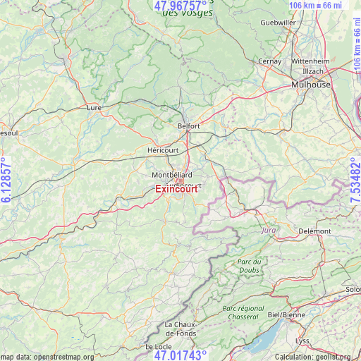
Exincourt GPS coordinates[2]
47° 29' 40.74" North, 6° 49' 54.084" East
| Map corner | latitude | longitude |
|---|---|---|
| Upper-left | 47.96757°, | 6.12857° |
| Center: | 47.49465°, | 6.83169° |
| Lower-right: | 47.01743°, | 7.53482° |
| Map W x H: | 105.6×105.6 km | = 65.6×65.6mi |
| max Lat: | 51.07786° ⇑48.9% North |
| Exincourt: | 47.49465° |
| min Lat: | ⇓51.1% South 41.3874° |
| min Long | Exincourt | max Long |
| -5.08615° | 6.83169° | 9.52242° |
| W 93.8%⇐ | ⇒6.2% E |
Elevation
Elevation of Exincourt is 320 m = 1050 ft, and this is 126.3 m = 414 ft above average elevation for this country.
| Max E: |
2333 m = 7654 ft | 17.2% |
| Exincourt | 320 m 1050 ft | |
| Avg. | 193.7 m = 635 ft | |
Min E: |
-1 m = -3 ft | 82.8% |
See also: France elevation on elevation.city.
Geographical zone
Exincourt is located in North temperate zone (between Tropic of Cancer and the Arctic Circle). Distance of this North polar circle is 2120.3 km =1317.5 mi to North.| Distance of | km | miles | from Exincourt |
|---|---|---|---|
| North Pole | 4726.2 | 2936.7 | to North |
| Arctic Circle | 2120.3 | 1317.5 | to North |
| Tropic Cancer | 2675 | 1662.2 | to South |
| Equator | 5280.9 | 3281.4 | to South |


Nearby cities:
15 places around Exincourt: (largest is in red/bold)
• Arbouans
2.8 km =1.7 mi,  280°
280°
• Audincourt
2.1 km =1.3 mi,  127°
127°
• Bart
4.6 km =2.9 mi,  261°
261°
• Courcelles-lès-Montbéliard
3.6 km =2.2 mi, 281°
• Grand-Charmont
3.6 km =2.2 mi,  353°
353°
• Montbéliard
3 km =1.9 mi,  303°
303°
• Nommay
4.9 km =3 mi,  9°
9°
• Sainte-Suzanne
4.8 km =3 mi, 277°
• Seloncourt
4.3 km =2.7 mi,  155°
155°
• Sochaux
1.5 km =0.9 mi, 348°
• Taillecourt
1.7 km =1.1 mi,  87°
87°
• Valentigney
3.4 km =2.1 mi,  180°
180°
• Vieux-Charmont
3.1 km =1.9 mi, 8°
• Voujeaucourt
4.8 km =3 mi,  243°
243°
• Étupes
3.2 km =2 mi,  68°
68°
Sources, notices
• [Note1] Compared only with cities in France existing in our database
• [Src1] Map data: © OpenStreetMap contributors (CC-BY-SA)
• [Src2] Other city data from geonames.org with taken over terms of usage.
• [Src3] Geographical zone / Annual Mean Temperature by Robert A. Rohde @ Wikipedia
