Villiers-sur-Marne geodata
Villiers-sur-Marne (Île-de-France) is a populated place; located in France in Europe/Paris (GMT+2) time zone. With population of 30,252 people, there are 268 cities with bigger population in this country. Compared to other cities in France, 76.2% of cities are located further ↓South; 51.4% of cities are located further ←West and 62% of cities have higher elevation than Villiers-sur-Marne. Note1
Administrative division(s):
- Level 1: Île-de-France
- Level 2: Val-de-Marne
- Level 3: Arrondissement de Nogent-sur-Marne
- Level 4: Villiers-sur-Marne


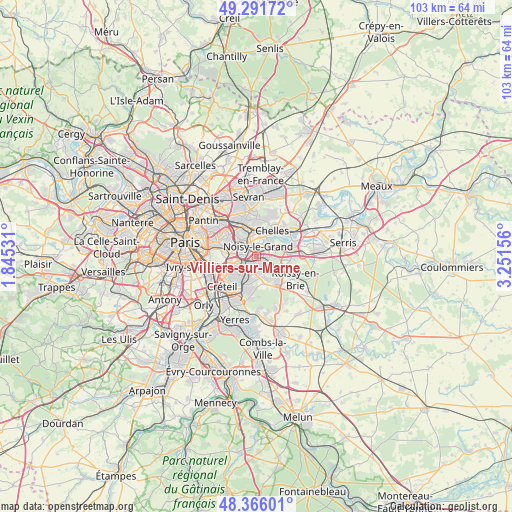
Villiers-sur-Marne GPS coordinates[2]
48° 49' 51.6" North, 2° 32' 54.384" East
| Map corner | latitude | longitude |
|---|---|---|
| Upper-left | 49.29172°, | 1.84531° |
| Center: | 48.831°, | 2.54844° |
| Lower-right: | 48.36601°, | 3.25156° |
| Map W x H: | 102.9×102.9 km | = 63.9×63.9mi |
| max Lat: | 51.07786° ⇑23.8% North |
| Villiers-sur-Marne: | 48.831° |
| min Lat: | ⇓76.2% South 41.3874° |
| min Long | Villiers-sur-Ma | max Long |
| -5.08615° | 2.54844° | 9.52242° |
| W 51.4%⇐ | ⇒48.6% E |
Elevation
Elevation of Villiers-sur-Marne is 97 m = 318 ft, and this is 96.7 m = 317 ft below average elevation for this country.
| Max E: |
2333 m = 7654 ft | 62% |
| Avg. | 193.7 m = 635 ft | |
| Villiers-sur-Marne | 97 m = 318 ft | |
Min E: |
-1 m = -3 ft | 38% |
See also: France elevation on elevation.city.
Geographical zone
Villiers-sur-Marne is located in North temperate zone (between Tropic of Cancer and the Arctic Circle). Distance of this North polar circle is 1971.7 km =1225.2 mi to North.| Distance of | km | miles | from Villiers-sur-Marne |
|---|---|---|---|
| North Pole | 4577.6 | 2844.4 | to North |
| Arctic Circle | 1971.7 | 1225.2 | to North |
| Tropic Cancer | 2823.6 | 1754.5 | to South |
| Equator | 5429.5 | 3373.7 | to South |


Nearby cities:
15 places around Villiers-sur-Marne: (largest is in red/bold)
• Bry-sur-Marne
1.9 km =1.2 mi,  294°
294°
• Champigny-sur-Marne
4.3 km =2.7 mi,  247°
247°
• Champs-sur-Marne
4.3 km =2.7 mi,  60°
60°
• Chennevières-sur-Marne
3.8 km =2.4 mi,  188°
188°
• Fontenay-sous-Bois
5.5 km =3.4 mi,  298°
298°
• Gournay-sur-Marne
4.4 km =2.7 mi,  37°
37°
• Joinville-le-Pont
5.4 km =3.4 mi,  263°
263°
• Le Perreux-sur-Marne
4.1 km =2.5 mi, 300°
• Le Plessis-Trévise
2.9 km =1.8 mi,  140°
140°
• Neuilly-Plaisance
4.8 km =3 mi,  319°
319°
• Neuilly-sur-Marne
2.5 km =1.6 mi,  0°
0°
• Nogent-sur-Marne
4.9 km =3 mi,  277°
277°
• Noisy-le-Grand
2.3 km =1.4 mi,  26°
26°
• Ormesson-sur-Marne
5 km =3.1 mi,  183°
183°
• Pontault-Combault
5.6 km =3.5 mi,  130°
130°
Sources, notices
• [Note1] Compared only with cities in France existing in our database
• [Src1] Map data: © OpenStreetMap contributors (CC-BY-SA)
• [Src2] Other city data from geonames.org with taken over terms of usage.
• [Src3] Geographical zone / Annual Mean Temperature by Robert A. Rohde @ Wikipedia
