Chennevières-sur-Marne geodata
Chennevières-sur-Marne (Île-de-France) is a populated place; located in France in Europe/Paris (GMT+2) time zone. With population of 18,314 people, there are 516 cities with bigger population in this country. Compared to other cities in France, 75.5% of cities are located further ↓South; 51.2% of cities are located further ←West and 59.4% of cities have higher elevation than Chennevières-sur-Marne. Note1
Administrative division(s):
- Level 1: Île-de-France
- Level 2: Val-de-Marne
- Level 3: Arrondissement de Créteil
- Level 4: Chennevières-sur-Marne


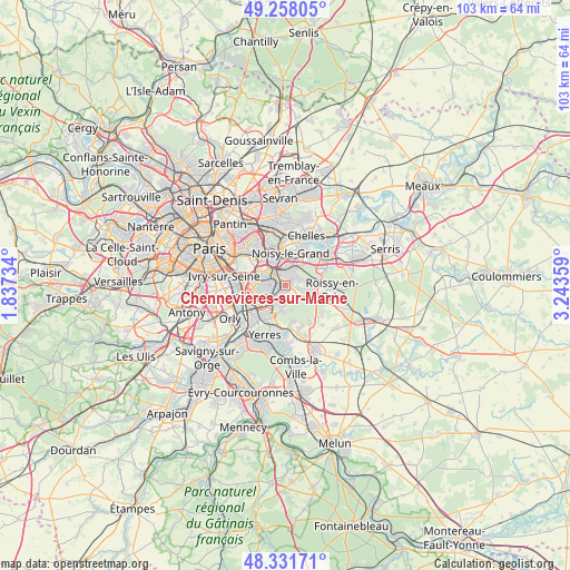
Chennevières-sur-Marne GPS coordinates[2]
48° 47' 49.272" North, 2° 32' 25.656" East
| Map corner | latitude | longitude |
|---|---|---|
| Upper-left | 49.25805°, | 1.83734° |
| Center: | 48.79702°, | 2.54046° |
| Lower-right: | 48.33171°, | 3.24359° |
| Map W x H: | 103×103 km | = 64×64mi |
| max Lat: | 51.07786° ⇑24.5% North |
| Chennevières-sur-Marne: | 48.79702° |
| min Lat: | ⇓75.5% South 41.3874° |
| min Long | Chennevières-s | max Long |
| -5.08615° | 2.54046° | 9.52242° |
| W 51.2%⇐ | ⇒48.8% E |
Elevation
Elevation of Chennevières-sur-Marne is 104 m = 341 ft, and this is 89.7 m = 294 ft below average elevation for this country.
| Max E: |
2333 m = 7654 ft | 59.4% |
| Avg. | 193.7 m = 635 ft | |
| Chennevières-sur-Marne | 104 m = 341 ft | |
Min E: |
-1 m = -3 ft | 40.6% |
See also: France elevation on elevation.city.
Geographical zone
Chennevières-sur-Marne is located in North temperate zone (between Tropic of Cancer and the Arctic Circle). Distance of this North polar circle is 1975.5 km =1227.5 mi to North.| Distance of | km | miles | from Chennevières-sur-Marne |
|---|---|---|---|
| North Pole | 4581.3 | 2846.7 | to North |
| Arctic Circle | 1975.5 | 1227.5 | to North |
| Tropic Cancer | 2819.8 | 1752.1 | to South |
| Equator | 5425.7 | 3371.4 | to South |


Nearby cities:
15 places around Chennevières-sur-Marne: (largest is in red/bold)
• Boissy-Saint-Léger
5.5 km =3.4 mi,  202°
202°
• Bonneuil-sur-Marne
5.4 km =3.4 mi,  235°
235°
• Bry-sur-Marne
4.7 km =2.9 mi,  345°
345°
• Champigny-sur-Marne
4 km =2.5 mi,  302°
302°
• Créteil
5.5 km =3.4 mi,  264°
264°
• Joinville-le-Pont
5.8 km =3.6 mi, 303°
• La Queue-en-Brie
3.3 km =2.1 mi,  113°
113°
• Le Plessis-Trévise
2.9 km =1.8 mi,  57°
57°
• Noiseau
2.4 km =1.5 mi,  165°
165°
• Noisy-le-Grand
6.1 km =3.8 mi,  15°
15°
• Ormesson-sur-Marne
1.2 km =0.7 mi, 165°
• Pontault-Combault
4.9 km =3 mi,  88°
88°
• Saint-Maur-des-Fossés
3.5 km =2.2 mi, 264°
• Sucy-en-Brie
3.2 km =2 mi,  187°
187°
• Villiers-sur-Marne
3.8 km =2.4 mi,  8°
8°
Sources, notices
• [Note1] Compared only with cities in France existing in our database
• [Src1] Map data: © OpenStreetMap contributors (CC-BY-SA)
• [Src2] Other city data from geonames.org with taken over terms of usage.
• [Src3] Geographical zone / Annual Mean Temperature by Robert A. Rohde @ Wikipedia
