Ville-sous-la-Ferté geodata
Ville-sous-la-Ferté (Grand Est) is a populated place; located in France in Europe/Paris (GMT+2) time zone. With population of 1,293 people, there are 7069 cities with bigger population in this country. Compared to other cities in France, 61.5% of cities are located further ↓South; 74.9% of cities are located further ←West and 66.6% of cities have lower elevation than Ville-sous-la-Ferté. Note1
Administrative division(s):
- Level 1: Grand Est
- Level 2: Département de l'Aube
- Level 3: Arrondissement de Bar-sur-Aube
- Level 4: Ville-sous-la-Ferté


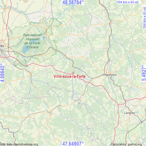
Ville-sous-la-Ferté GPS coordinates[2]
48° 7' 14.16" North, 4° 47' 22.452" East
| Map corner | latitude | longitude |
|---|---|---|
| Upper-left | 48.58784°, | 4.08645° |
| Center: | 48.1206°, | 4.78957° |
| Lower-right: | 47.64907°, | 5.4927° |
| Map W x H: | 104.4×104.4 km | = 64.9×64.9mi |
| max Lat: | 51.07786° ⇑38.5% North |
| Ville-sous-la-Ferté: | 48.1206° |
| min Lat: | ⇓61.5% South 41.3874° |
| min Long | Ville-sous-la-F | max Long |
| -5.08615° | 4.78957° | 9.52242° |
| W 74.9%⇐ | ⇒25.1% E |
Elevation
Elevation of Ville-sous-la-Ferté is 202 m = 663 ft, and this is 8.3 m = 27 ft above average elevation for this country.
| Max E: |
2333 m = 7654 ft | 33.4% |
| Ville-sous-la-Ferté | 202 m 663 ft | |
| Avg. | 193.7 m = 635 ft | |
Min E: |
-1 m = -3 ft | 66.6% |
See also: France elevation on elevation.city.
Geographical zone
Ville-sous-la-Ferté is located in North temperate zone (between Tropic of Cancer and the Arctic Circle). Distance of this North polar circle is 2050.7 km =1274.2 mi to North.| Distance of | km | miles | from Ville-sous-la-Ferté |
|---|---|---|---|
| North Pole | 4656.6 | 2893.5 | to North |
| Arctic Circle | 2050.7 | 1274.2 | to North |
| Tropic Cancer | 2744.6 | 1705.4 | to South |
| Equator | 5350.5 | 3324.6 | to South |


Nearby cities:
15 places around Ville-sous-la-Ferté: (largest is in red/bold)
• Arc-en-Barrois
25.2 km =15.7 mi,  139°
139°
• Bar-sur-Aube
14 km =8.7 mi,  333°
333°
• Bayel
8.7 km =5.4 mi,  354°
354°
• Chamarandes-Choignes
27.1 km =16.8 mi,  98°
98°
• Chaumont
26.1 km =16.2 mi,  92°
92°
• Châteauvillain
13.4 km =8.3 mi,  134°
134°
• Colombey-les-Deux-Églises
12.7 km =7.9 mi,  33°
33°
• Essoyes
20.2 km =12.6 mi,  249°
249°
• Jonchery
22.1 km =13.7 mi, 85°
• Landreville
24.1 km =15 mi,  257°
257°
• Lavilleneuve-au-Roi
11 km =6.8 mi,  66°
66°
• Montsaon
18.7 km =11.6 mi, 102°
• Mussy-sur-Seine
26.9 km =16.7 mi,  233°
233°
• Vendeuvre-sur-Barse
27.1 km =16.8 mi,  298°
298°
• Villiers-le-Sec
20.3 km =12.6 mi, 95°
Sources, notices
• [Note1] Compared only with cities in France existing in our database
• [Src1] Map data: © OpenStreetMap contributors (CC-BY-SA)
• [Src2] Other city data from geonames.org with taken over terms of usage.
• [Src3] Geographical zone / Annual Mean Temperature by Robert A. Rohde @ Wikipedia
