Essoyes geodata
Essoyes (Grand Est) is a populated place; located in France in Europe/Paris (GMT+2) time zone. With population of 662 people, there are 12351 cities with bigger population in this country. Compared to other cities in France, 60.3% of cities are located further ↓South; 72.3% of cities are located further ←West and 64.2% of cities have lower elevation than Essoyes. Note1
Administrative division(s):
- Level 1: Grand Est
- Level 2: Département de l'Aube
- Level 3: Arrondissement de Troyes
- Level 4: Essoyes


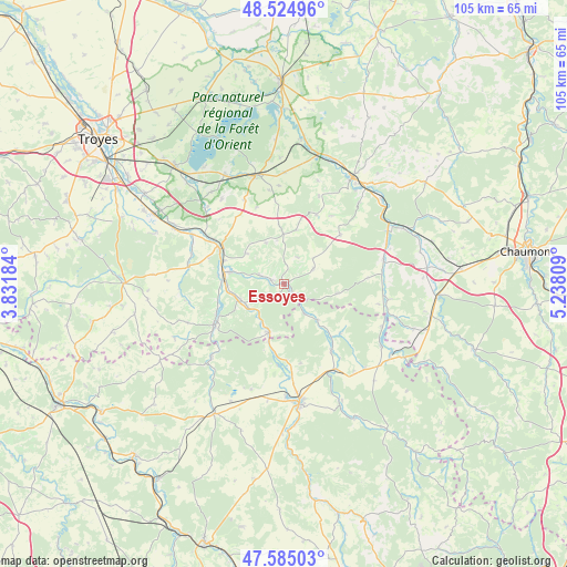
Essoyes GPS coordinates[2]
48° 3' 25.704" North, 4° 32' 5.892" East
| Map corner | latitude | longitude |
|---|---|---|
| Upper-left | 48.52496°, | 3.83184° |
| Center: | 48.05714°, | 4.53497° |
| Lower-right: | 47.58503°, | 5.23809° |
| Map W x H: | 104.5×104.5 km | = 64.9×64.9mi |
| max Lat: | 51.07786° ⇑39.7% North |
| Essoyes: | 48.05714° |
| min Lat: | ⇓60.3% South 41.3874° |
| min Long | Essoyes | max Long |
| -5.08615° | 4.53497° | 9.52242° |
| W 72.3%⇐ | ⇒27.7% E |
Elevation
Elevation of Essoyes is 190 m = 623 ft, and this is 3.7 m = 12 ft below average elevation for this country.
| Max E: |
2333 m = 7654 ft | 35.8% |
| Avg. | 193.7 m = 635 ft | |
| Essoyes | 190 m = 623 ft | |
Min E: |
-1 m = -3 ft | 64.2% |
See also: France elevation on elevation.city.
Geographical zone
Essoyes is located in North temperate zone (between Tropic of Cancer and the Arctic Circle). Distance of this North polar circle is 2057.7 km =1278.6 mi to North.| Distance of | km | miles | from Essoyes |
|---|---|---|---|
| North Pole | 4663.6 | 2897.8 | to North |
| Arctic Circle | 2057.7 | 1278.6 | to North |
| Tropic Cancer | 2737.5 | 1701 | to South |
| Equator | 5343.5 | 3320.3 | to South |


Nearby cities:
15 places around Essoyes: (largest is in red/bold)
• Bar-sur-Aube
23.3 km =14.5 mi,  33°
33°
• Bar-sur-Seine
13.3 km =8.3 mi,  297°
297°
• Bayel
23.9 km =14.9 mi,  48°
48°
• Châteauvillain
28.6 km =17.8 mi,  94°
94°
• Châtillon-sur-Seine
22.3 km =13.9 mi,  172°
172°
• Gyé-sur-Seine
8.5 km =5.3 mi,  249°
249°
• Laignes
27 km =16.8 mi,  208°
208°
• Landreville
5 km =3.1 mi,  291°
291°
• Les Riceys
14.1 km =8.8 mi,  240°
240°
• Mussy-sur-Seine
9.2 km =5.7 mi,  197°
197°
• Saint-Parres-lès-Vaudes
26.8 km =16.7 mi, 298°
• Vendeuvre-sur-Barse
20.7 km =12.9 mi,  346°
346°
• Ville-sous-la-Ferté
20.2 km =12.6 mi,  69°
69°
• Villemoyenne
26.5 km =16.5 mi, 300°
• Virey-sous-Bar
19 km =11.8 mi, 298°
Sources, notices
• [Note1] Compared only with cities in France existing in our database
• [Src1] Map data: © OpenStreetMap contributors (CC-BY-SA)
• [Src2] Other city data from geonames.org with taken over terms of usage.
• [Src3] Geographical zone / Annual Mean Temperature by Robert A. Rohde @ Wikipedia
