Villers-Outréaux geodata
Villers-Outréaux (Hauts-de-France) is a populated place; located in France in Europe/Paris (GMT+2) time zone. With population of 2,261 people, there are 4259 cities with bigger population in this country. Compared to other cities in France, 93.8% of cities are located further ↓South; 62% of cities are located further ←West and 50.8% of cities have lower elevation than Villers-Outréaux. Note1
Administrative division(s):
- Level 1: Hauts-de-France
- Level 2: Nord
- Level 3: Arrondissement de Cambrai
- Level 4: Villers-Outréaux


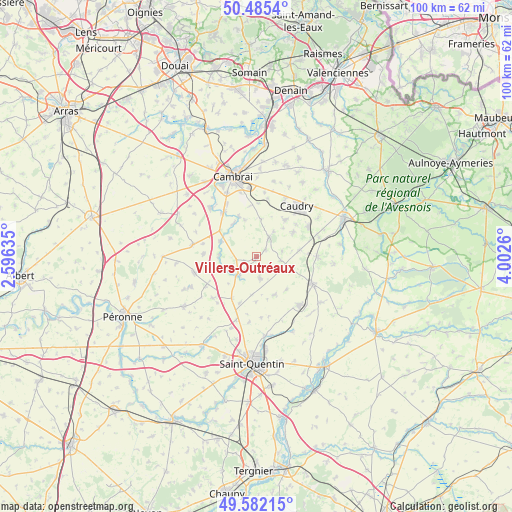
Villers-Outréaux GPS coordinates[2]
50° 2' 9.24" North, 3° 17' 58.092" East
| Map corner | latitude | longitude |
|---|---|---|
| Upper-left | 50.4854°, | 2.59635° |
| Center: | 50.0359°, | 3.29947° |
| Lower-right: | 49.58215°, | 4.0026° |
| Map W x H: | 100.4×100.4 km | = 62.4×62.4mi |
| max Lat: | 51.07786° ⇑6.2% North |
| Villers-Outréaux: | 50.0359° |
| min Lat: | ⇓93.8% South 41.3874° |
| min Long | Villers-Outréa | max Long |
| -5.08615° | 3.29947° | 9.52242° |
| W 62%⇐ | ⇒38% E |
Elevation
Elevation of Villers-Outréaux is 135 m = 443 ft, and this is 58.7 m = 193 ft below average elevation for this country.
| Max E: |
2333 m = 7654 ft | 49.2% |
| Avg. | 193.7 m = 635 ft | |
| Villers-Outréaux | 135 m = 443 ft | |
Min E: |
-1 m = -3 ft | 50.8% |
See also: France elevation on elevation.city.
Geographical zone
Villers-Outréaux is located in North temperate zone (between Tropic of Cancer and the Arctic Circle). Distance of this North polar circle is 1837.7 km =1141.9 mi to North.| Distance of | km | miles | from Villers-Outréaux |
|---|---|---|---|
| North Pole | 4443.6 | 2761.1 | to North |
| Arctic Circle | 1837.7 | 1141.9 | to North |
| Tropic Cancer | 2957.6 | 1837.8 | to South |
| Equator | 5563.5 | 3457 | to South |


Nearby cities:
15 places around Villers-Outréaux: (largest is in red/bold)
• Beaurevoir
4.4 km =2.7 mi,  171°
171°
• Bellicourt
9.4 km =5.8 mi,  209°
209°
• Brancourt-le-Grand
8.9 km =5.5 mi,  138°
138°
• Clary
8.5 km =5.3 mi,  56°
56°
• Esnes
7.3 km =4.5 mi,  7°
7°
• Gouy
5 km =3.1 mi,  218°
218°
• Honnecourt-sur-Escaut
7.1 km =4.4 mi,  267°
267°
• Les Rues-des-Vignes
8 km =5 mi,  326°
326°
• Ligny-en-Cambrésis
9.2 km =5.7 mi,  37°
37°
• Maretz
8.5 km =5.3 mi,  82°
82°
• Montbrehain
8.5 km =5.3 mi,  155°
155°
• Prémont
7 km =4.3 mi,  109°
109°
• Selvigny
6 km =3.7 mi, 35°
• Walincourt-Selvigny
4.2 km =2.6 mi, 35°
• Élincourt
5.2 km =3.2 mi, 79°
Sources, notices
• [Note1] Compared only with cities in France existing in our database
• [Src1] Map data: © OpenStreetMap contributors (CC-BY-SA)
• [Src2] Other city data from geonames.org with taken over terms of usage.
• [Src3] Geographical zone / Annual Mean Temperature by Robert A. Rohde @ Wikipedia
