Les Rues-des-Vignes geodata
Les Rues-des-Vignes (Hauts-de-France) is a populated place; located in France in Europe/Paris (GMT+2) time zone. With population of 684 people, there are 12023 cities with bigger population in this country. Compared to other cities in France, 94.2% of cities are located further ↓South; 61.1% of cities are located further ←West and 65.3% of cities have higher elevation than Les Rues-des-Vignes. Note1
Administrative division(s):
- Level 1: Hauts-de-France
- Level 2: Nord
- Level 3: Arrondissement de Cambrai
- Level 4: Les Rues-des-Vignes


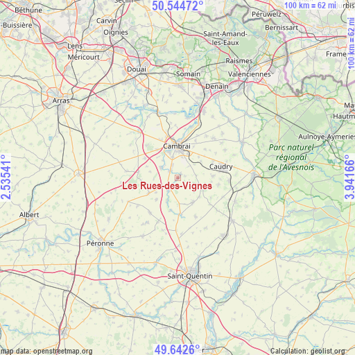
Les Rues-des-Vignes GPS coordinates[2]
50° 5' 44.808" North, 3° 14' 18.708" East
| Map corner | latitude | longitude |
|---|---|---|
| Upper-left | 50.54472°, | 2.53541° |
| Center: | 50.09578°, | 3.23853° |
| Lower-right: | 49.6426°, | 3.94166° |
| Map W x H: | 100.3×100.3 km | = 62.3×62.3mi |
| max Lat: | 51.07786° ⇑5.8% North |
| Les Rues-des-Vignes: | 50.09578° |
| min Lat: | ⇓94.2% South 41.3874° |
| min Long | Les Rues-des-Vi | max Long |
| -5.08615° | 3.23853° | 9.52242° |
| W 61.1%⇐ | ⇒38.9% E |
Elevation
Elevation of Les Rues-des-Vignes is 89 m = 292 ft, and this is 104.7 m = 344 ft below average elevation for this country.
| Max E: |
2333 m = 7654 ft | 65.3% |
| Avg. | 193.7 m = 635 ft | |
| Les Rues-des-Vignes | 89 m = 292 ft | |
Min E: |
-1 m = -3 ft | 34.7% |
See also: France elevation on elevation.city.
Geographical zone
Les Rues-des-Vignes is located in North temperate zone (between Tropic of Cancer and the Arctic Circle). Distance of this North polar circle is 1831 km =1137.7 mi to North.| Distance of | km | miles | from Les Rues-des-Vignes |
|---|---|---|---|
| North Pole | 4436.9 | 2757 | to North |
| Arctic Circle | 1831 | 1137.7 | to North |
| Tropic Cancer | 2964.2 | 1841.9 | to South |
| Equator | 5570.1 | 3461.1 | to South |


Nearby cities:
15 places around Les Rues-des-Vignes: (largest is in red/bold)
• Awoingt
7.3 km =4.5 mi,  24°
24°
• Cambrai
8.9 km =5.5 mi,  358°
358°
• Cattenières
8.1 km =5 mi,  57°
57°
• Esnes
5.4 km =3.4 mi,  83°
83°
• Honnecourt-sur-Escaut
7.5 km =4.7 mi,  201°
201°
• Marcoing
5.4 km =3.4 mi,  301°
301°
• Masnières
3 km =1.9 mi,  315°
315°
• Niergnies
5.9 km =3.7 mi,  12°
12°
• Noyelles-sur-Escaut
5.7 km =3.5 mi, 316°
• Proville
7.6 km =4.7 mi,  342°
342°
• Rumilly-en-Cambrésis
3.7 km =2.3 mi, 337°
• Selvigny
8.1 km =5 mi,  102°
102°
• Villers-Guislain
8.6 km =5.3 mi,  224°
224°
• Villers-Outréaux
8 km =5 mi,  146°
146°
• Walincourt-Selvigny
7.5 km =4.7 mi,  115°
115°
Sources, notices
• [Note1] Compared only with cities in France existing in our database
• [Src1] Map data: © OpenStreetMap contributors (CC-BY-SA)
• [Src2] Other city data from geonames.org with taken over terms of usage.
• [Src3] Geographical zone / Annual Mean Temperature by Robert A. Rohde @ Wikipedia
