Gouy geodata
Gouy (Hauts-de-France) is a populated place; located in France in Europe/Paris (GMT+2) time zone. With population of 654 people, there are 12467 cities with bigger population in this country. Compared to other cities in France, 93.6% of cities are located further ↓South; 61.4% of cities are located further ←West and 62% of cities have higher elevation than Gouy. Note1
Administrative division(s):
- Level 1: Hauts-de-France
- Level 2: Département de l'Aisne
- Level 3: Arrondissement de Saint-Quentin
- Level 4: Gouy


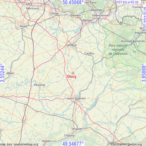
Gouy GPS coordinates[2]
50° 0' 3.06" North, 3° 15' 20.016" East
| Map corner | latitude | longitude |
|---|---|---|
| Upper-left | 50.45068°, | 2.55244° |
| Center: | 50.00085°, | 3.25556° |
| Lower-right: | 49.54677°, | 3.95869° |
| Map W x H: | 100.5×100.5 km | = 62.4×62.4mi |
| max Lat: | 51.07786° ⇑6.4% North |
| Gouy: | 50.00085° |
| min Lat: | ⇓93.6% South 41.3874° |
| min Long | Gouy | max Long |
| -5.08615° | 3.25556° | 9.52242° |
| W 61.4%⇐ | ⇒38.6% E |
Elevation
Elevation of Gouy is 97 m = 318 ft, and this is 96.7 m = 317 ft below average elevation for this country.
| Max E: |
2333 m = 7654 ft | 62% |
| Avg. | 193.7 m = 635 ft | |
| Gouy | 97 m = 318 ft | |
Min E: |
-1 m = -3 ft | 38% |
See also: France elevation on elevation.city.
Geographical zone
Gouy is located in North temperate zone (between Tropic of Cancer and the Arctic Circle). Distance of this North polar circle is 1841.6 km =1144.3 mi to North.| Distance of | km | miles | from Gouy |
|---|---|---|---|
| North Pole | 4447.5 | 2763.5 | to North |
| Arctic Circle | 1841.6 | 1144.3 | to North |
| Tropic Cancer | 2953.7 | 1835.3 | to South |
| Equator | 5559.6 | 3454.6 | to South |


Nearby cities:
15 places around Gouy: (largest is in red/bold)
• Beaurevoir
3.8 km =2.4 mi,  96°
96°
• Bellicourt
4.6 km =2.9 mi,  198°
198°
• Brancourt-le-Grand
9.4 km =5.8 mi,  106°
106°
• Hargicourt
7 km =4.3 mi,  231°
231°
• Honnecourt-sur-Escaut
5.4 km =3.4 mi,  312°
312°
• Levergies
9.3 km =5.8 mi,  154°
154°
• Montbrehain
7.7 km =4.8 mi,  119°
119°
• Nauroy
5.3 km =3.3 mi,  180°
180°
• Prémont
9.9 km =6.2 mi,  80°
80°
• Ronssoy
7.1 km =4.4 mi,  253°
253°
• Villers-Guislain
8.4 km =5.2 mi,  301°
301°
• Villers-Outréaux
5 km =3.1 mi,  38°
38°
• Walincourt-Selvigny
9.2 km =5.7 mi, 37°
• Élincourt
9.6 km =6 mi,  59°
59°
• Épehy
8.7 km =5.4 mi,  269°
269°
Sources, notices
• [Note1] Compared only with cities in France existing in our database
• [Src1] Map data: © OpenStreetMap contributors (CC-BY-SA)
• [Src2] Other city data from geonames.org with taken over terms of usage.
• [Src3] Geographical zone / Annual Mean Temperature by Robert A. Rohde @ Wikipedia
