Villentrois geodata
Villentrois (Centre) is a populated place; located in France in Europe/Paris (GMT+2) time zone. With population of 645 people, there are 12593 cities with bigger population in this country. Compared to other cities in France, 53.1% of cities are located further ↑North; 63.5% of cities are located further →East and 63.2% of cities have higher elevation than Villentrois. Note1
Administrative division(s):
- Level 1: Centre
- Level 2: Département de l'Indre
- Level 3: Arrondissement de Châteauroux
- Level 4: Villentrois-Faverolles-en-Berry


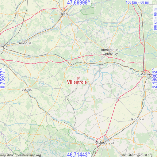
Villentrois GPS coordinates[2]
47° 11' 39.696" North, 1° 27' 46.404" East
| Map corner | latitude | longitude |
|---|---|---|
| Upper-left | 47.66999°, | 0.75977° |
| Center: | 47.19436°, | 1.46289° |
| Lower-right: | 46.71443°, | 2.16602° |
| Map W x H: | 106.2×106.2 km | = 66×66mi |
| max Lat: | 51.07786° ⇑53.1% North |
| Villentrois: | 47.19436° |
| min Lat: | ⇓46.9% South 41.3874° |
| min Long | Villentrois | max Long |
| -5.08615° | 1.46289° | 9.52242° |
| W 36.5%⇐ | ⇒63.5% E |
Elevation
Elevation of Villentrois is 94 m = 308 ft, and this is 99.7 m = 327 ft below average elevation for this country.
| Max E: |
2333 m = 7654 ft | 63.2% |
| Avg. | 193.7 m = 635 ft | |
| Villentrois | 94 m = 308 ft | |
Min E: |
-1 m = -3 ft | 36.8% |
See also: France elevation on elevation.city.
Geographical zone
Villentrois is located in North temperate zone (between Tropic of Cancer and the Arctic Circle). Distance of this North polar circle is 2153.7 km =1338.2 mi to North.| Distance of | km | miles | from Villentrois |
|---|---|---|---|
| North Pole | 4759.5 | 2957.4 | to North |
| Arctic Circle | 2153.7 | 1338.2 | to North |
| Tropic Cancer | 2641.6 | 1641.4 | to South |
| Equator | 5247.5 | 3260.6 | to South |


Nearby cities:
15 places around Villentrois: (largest is in red/bold)
• Châteauvieux
7.3 km =4.5 mi,  303°
303°
• Châtillon-sur-Cher
9.3 km =5.8 mi,  14°
14°
• Couffy
6.2 km =3.9 mi,  343°
343°
• La Vernelle
8.5 km =5.3 mi,  45°
45°
• Luçay-le-Mâle
7.3 km =4.5 mi,  192°
192°
• Lye
3.8 km =2.4 mi, 12°
• Meusnes
6.6 km =4.1 mi,  22°
22°
• Nouans-les-Fontaines
14 km =8.7 mi,  242°
242°
• Noyers-sur-Cher
10.2 km =6.3 mi,  333°
333°
• Saint-Aignan
10.6 km =6.6 mi,  321°
321°
• Seigy
8.4 km =5.2 mi, 325°
• Selles-sur-Cher
11.7 km =7.3 mi,  36°
36°
• Valençay
8.8 km =5.5 mi,  114°
114°
• Varennes-sur-Fouzon
11 km =6.8 mi,  79°
79°
• Vicq-sur-Nahon
11.4 km =7.1 mi,  149°
149°
Sources, notices
• [Note1] Compared only with cities in France existing in our database
• [Src1] Map data: © OpenStreetMap contributors (CC-BY-SA)
• [Src2] Other city data from geonames.org with taken over terms of usage.
• [Src3] Geographical zone / Annual Mean Temperature by Robert A. Rohde @ Wikipedia
