Luçay-le-Mâle geodata
Luçay-le-Mâle (Centre) is a populated place; located in France in Europe/Paris (GMT+2) time zone. With population of 1,712 people, there are 5489 cities with bigger population in this country. Compared to other cities in France, 53.9% of cities are located further ↑North; 63.7% of cities are located further →East and 53.8% of cities have higher elevation than Luçay-le-Mâle. Note1
Administrative division(s):
- Level 1: Centre
- Level 2: Département de l'Indre
- Level 3: Arrondissement de Châteauroux
- Level 4: Luçay-le-Mâle


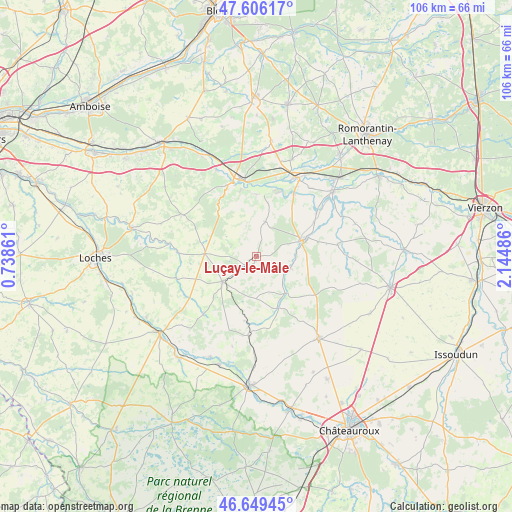
Luçay-le-Mâle GPS coordinates[2]
47° 7' 47.856" North, 1° 26' 30.228" East
| Map corner | latitude | longitude |
|---|---|---|
| Upper-left | 47.60617°, | 0.73861° |
| Center: | 47.12996°, | 1.44173° |
| Lower-right: | 46.64945°, | 2.14486° |
| Map W x H: | 106.4×106.4 km | = 66.1×66.1mi |
| max Lat: | 51.07786° ⇑53.9% North |
| Luçay-le-Mâle: | 47.12996° |
| min Lat: | ⇓46.1% South 41.3874° |
| min Long | Luçay-le-Mâle | max Long |
| -5.08615° | 1.44173° | 9.52242° |
| W 36.3%⇐ | ⇒63.7% E |
Elevation
Elevation of Luçay-le-Mâle is 120 m = 394 ft, and this is 73.7 m = 242 ft below average elevation for this country.
| Max E: |
2333 m = 7654 ft | 53.8% |
| Avg. | 193.7 m = 635 ft | |
| Luçay-le-Mâle | 120 m = 394 ft | |
Min E: |
-1 m = -3 ft | 46.2% |
See also: France elevation on elevation.city.
Geographical zone
Luçay-le-Mâle is located in North temperate zone (between Tropic of Cancer and the Arctic Circle). Distance of this North polar circle is 2160.8 km =1342.7 mi to North.| Distance of | km | miles | from Luçay-le-Mâle |
|---|---|---|---|
| North Pole | 4766.7 | 2961.9 | to North |
| Arctic Circle | 2160.8 | 1342.7 | to North |
| Tropic Cancer | 2634.4 | 1636.9 | to South |
| Equator | 5240.4 | 3256.2 | to South |


Nearby cities:
15 places around Luçay-le-Mâle: (largest is in red/bold)
• Baudres
13.1 km =8.1 mi,  127°
127°
• Châteauvieux
12.1 km =7.5 mi,  338°
338°
• Couffy
13.1 km =8.1 mi,  359°
359°
• La Vernelle
15.2 km =9.4 mi,  30°
30°
• Lye
11.2 km =7 mi,  12°
12°
• Meusnes
13.9 km =8.6 mi,  17°
17°
• Nouans-les-Fontaines
10.9 km =6.8 mi,  273°
273°
• Pellevoisin
16.4 km =10.2 mi,  186°
186°
• Saint-Aignan
16.2 km =10.1 mi, 342°
• Seigy
14.5 km =9 mi,  347°
347°
• Valençay
10.2 km =6.3 mi,  69°
69°
• Varennes-sur-Fouzon
15.4 km =9.6 mi,  53°
53°
• Vicq-sur-Nahon
7.8 km =4.8 mi,  109°
109°
• Villentrois
7.3 km =4.5 mi, 12°
• Écueillé
8.8 km =5.5 mi,  234°
234°
Sources, notices
• [Note1] Compared only with cities in France existing in our database
• [Src1] Map data: © OpenStreetMap contributors (CC-BY-SA)
• [Src2] Other city data from geonames.org with taken over terms of usage.
• [Src3] Geographical zone / Annual Mean Temperature by Robert A. Rohde @ Wikipedia
