Valençay geodata
Valençay (Centre) is a populated place; located in France in Europe/Paris (GMT+2) time zone. With population of 2,897 people, there are 3361 cities with bigger population in this country. Compared to other cities in France, 53.5% of cities are located further ↑North; 62.1% of cities are located further →East and 54.4% of cities have higher elevation than Valençay. Note1
Administrative division(s):
- Level 1: Centre
- Level 2: Département de l'Indre
- Level 3: Arrondissement de Châteauroux
- Level 4: Valençay


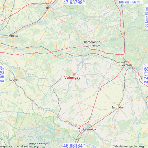
Valençay GPS coordinates[2]
47° 9' 43.452" North, 1° 34' 6.672" East
| Map corner | latitude | longitude |
|---|---|---|
| Upper-left | 47.63799°, | 0.8654° |
| Center: | 47.16207°, | 1.56852° |
| Lower-right: | 46.68184°, | 2.27165° |
| Map W x H: | 106.3×106.3 km | = 66.1×66.1mi |
| max Lat: | 51.07786° ⇑53.5% North |
| Valençay: | 47.16207° |
| min Lat: | ⇓46.5% South 41.3874° |
| min Long | Valençay | max Long |
| -5.08615° | 1.56852° | 9.52242° |
| W 37.9%⇐ | ⇒62.1% E |
Elevation
Elevation of Valençay is 118 m = 387 ft, and this is 75.7 m = 248 ft below average elevation for this country.
| Max E: |
2333 m = 7654 ft | 54.4% |
| Avg. | 193.7 m = 635 ft | |
| Valençay | 118 m = 387 ft | |
Min E: |
-1 m = -3 ft | 45.6% |
See also: France elevation on elevation.city.
Geographical zone
Valençay is located in North temperate zone (between Tropic of Cancer and the Arctic Circle). Distance of this North polar circle is 2157.2 km =1340.4 mi to North.| Distance of | km | miles | from Valençay |
|---|---|---|---|
| North Pole | 4763.1 | 2959.7 | to North |
| Arctic Circle | 2157.2 | 1340.4 | to North |
| Tropic Cancer | 2638 | 1639.2 | to South |
| Equator | 5243.9 | 3258.4 | to South |


Nearby cities:
15 places around Valençay: (largest is in red/bold)
• Baudres
11.6 km =7.2 mi,  176°
176°
• Chabris
11.9 km =7.4 mi,  31°
31°
• Châteauvieux
16 km =9.9 mi,  298°
298°
• Châtillon-sur-Cher
13.8 km =8.6 mi,  336°
336°
• Couffy
13.6 km =8.5 mi,  314°
314°
• Gièvres
15 km =9.3 mi, 30°
• La Vernelle
9.8 km =6.1 mi,  348°
348°
• Luçay-le-Mâle
10.2 km =6.3 mi,  249°
249°
• Lye
10.2 km =6.3 mi,  315°
315°
• Meusnes
11.1 km =6.9 mi,  330°
330°
• Poulaines
7.2 km =4.5 mi,  98°
98°
• Selles-sur-Cher
13.1 km =8.1 mi,  355°
355°
• Varennes-sur-Fouzon
6.3 km =3.9 mi, 26°
• Vicq-sur-Nahon
6.6 km =4.1 mi,  199°
199°
• Villentrois
8.8 km =5.5 mi,  294°
294°
Sources, notices
• [Note1] Compared only with cities in France existing in our database
• [Src1] Map data: © OpenStreetMap contributors (CC-BY-SA)
• [Src2] Other city data from geonames.org with taken over terms of usage.
• [Src3] Geographical zone / Annual Mean Temperature by Robert A. Rohde @ Wikipedia
