Villé geodata
Villé (Grand Est) is a populated place; located in France in Europe/Paris (GMT+2) time zone. With population of 1,685 people, there are 5562 cities with bigger population in this country. Compared to other cities in France, 65.3% of cities are located further ↓South; 96.6% of cities are located further ←West and 81.9% of cities have lower elevation than Villé. Note1
Administrative division(s):
- Level 1: Grand Est
- Level 2: Bas-Rhin
- Level 3: Arrondissement de Sélestat-Erstein
- Level 4: Villé


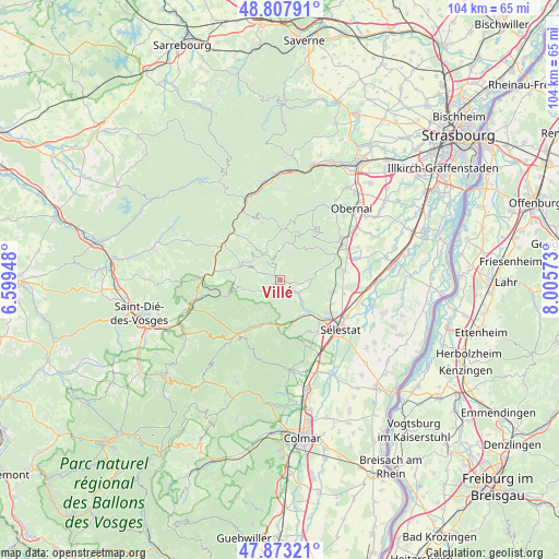
Villé GPS coordinates[2]
48° 20' 33.72" North, 7° 18' 9.36" East
| Map corner | latitude | longitude |
|---|---|---|
| Upper-left | 48.80791°, | 6.59948° |
| Center: | 48.3427°, | 7.3026° |
| Lower-right: | 47.87321°, | 8.00573° |
| Map W x H: | 103.9×103.9 km | = 64.6×64.6mi |
| max Lat: | 51.07786° ⇑34.7% North |
| Villé: | 48.3427° |
| min Lat: | ⇓65.3% South 41.3874° |
| min Long | Villé | max Long |
| -5.08615° | 7.3026° | 9.52242° |
| W 96.6%⇐ | ⇒3.4% E |
Elevation
Elevation of Villé is 310 m = 1017 ft, and this is 116.3 m = 382 ft above average elevation for this country.
| Max E: |
2333 m = 7654 ft | 18.1% |
| Villé | 310 m 1017 ft | |
| Avg. | 193.7 m = 635 ft | |
Min E: |
-1 m = -3 ft | 81.9% |
See also: France elevation on elevation.city.
Geographical zone
Villé is located in North temperate zone (between Tropic of Cancer and the Arctic Circle). Distance of this North polar circle is 2026 km =1258.9 mi to North.| Distance of | km | miles | from Villé |
|---|---|---|---|
| North Pole | 4631.9 | 2878.1 | to North |
| Arctic Circle | 2026 | 1258.9 | to North |
| Tropic Cancer | 2769.3 | 1720.8 | to South |
| Equator | 5375.2 | 3340 | to South |


Nearby cities:
15 places around Villé: (largest is in red/bold)
• Andlau
9.7 km =6 mi,  60°
60°
• Breitenbach
2.6 km =1.6 mi,  338°
338°
• Châtenois
10.7 km =6.6 mi,  137°
137°
• Dambach-la-Ville
9.3 km =5.8 mi,  103°
103°
• Dieffenbach-au-Val
3.5 km =2.2 mi,  149°
149°
• Fouchy
2.9 km =1.8 mi,  234°
234°
• Lièpvre
8 km =5 mi,  190°
190°
• Maisonsgoutte
3.2 km =2 mi,  290°
290°
• Neubois
4.9 km =3 mi, 145°
• Neuve-Église
1.8 km =1.1 mi, 153°
• Rombach-le-Franc
7.3 km =4.5 mi,  204°
204°
• Saint-Pierre-Bois
4.7 km =2.9 mi,  108°
108°
• Sainte-Croix-aux-Mines
10.5 km =6.5 mi,  211°
211°
• Scherwiller
10.7 km =6.6 mi,  125°
125°
• Steige
5.5 km =3.4 mi, 293°
Sources, notices
• [Note1] Compared only with cities in France existing in our database
• [Src1] Map data: © OpenStreetMap contributors (CC-BY-SA)
• [Src2] Other city data from geonames.org with taken over terms of usage.
• [Src3] Geographical zone / Annual Mean Temperature by Robert A. Rohde @ Wikipedia
