Sainte-Croix-aux-Mines geodata
Sainte-Croix-aux-Mines (Grand Est) is a populated place; located in France in Europe/Paris (GMT+2) time zone. With population of 2,122 people, there are 4541 cities with bigger population in this country. Compared to other cities in France, 63.9% of cities are located further ↓South; 96% of cities are located further ←West and 84.3% of cities have lower elevation than Sainte-Croix-aux-Mines. Note1
Administrative division(s):
- Level 1: Grand Est
- Level 2: Haut-Rhin
- Level 3: Arrondissement de Colmar-Ribeauvillé
- Level 4: Sainte-Croix-aux-Mines
Current local time in Sainte-Croix-aux-Mines:
01:44 PM, WednesdayDifference from your time zone: hours


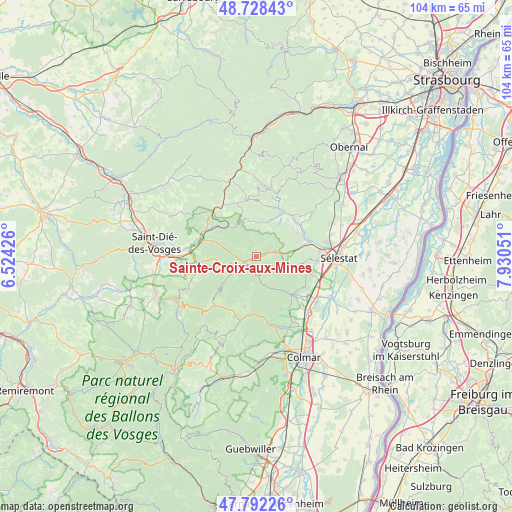
Sainte-Croix-aux-Mines GPS coordinates[2]
48° 15' 44.964" North, 7° 13' 38.604" East
| Map corner | latitude | longitude |
|---|---|---|
| Upper-left | 48.72843°, | 6.52426° |
| Center: | 48.26249°, | 7.22739° |
| Lower-right: | 47.79226°, | 7.93051° |
| Map W x H: | 104.1×104.1 km | = 64.7×64.7mi |
| max Lat: | 51.07786° ⇑36.1% North |
| Sainte-Croix-aux-Mines: | 48.26249° |
| min Lat: | ⇓63.9% South 41.3874° |
| min Long | Sainte-Croix-au | max Long |
| -5.08615° | 7.22739° | 9.52242° |
| W 96%⇐ | ⇒4% E |
Elevation
Elevation of Sainte-Croix-aux-Mines is 339 m = 1112 ft, and this is 145.3 m = 477 ft above average elevation for this country.
| Max E: |
2333 m = 7654 ft | 15.7% |
| Sainte-Croix-aux-Mines | 339 m 1112 ft | |
| Avg. | 193.7 m = 635 ft | |
Min E: |
-1 m = -3 ft | 84.3% |
See also: France elevation on elevation.city.
Geographical zone
Sainte-Croix-aux-Mines is located in North temperate zone (between Tropic of Cancer and the Arctic Circle). Distance of this North polar circle is 2034.9 km =1264.4 mi to North.| Distance of | km | miles | from Sainte-Croix-aux-Mines |
|---|---|---|---|
| North Pole | 4640.8 | 2883.7 | to North |
| Arctic Circle | 2034.9 | 1264.4 | to North |
| Tropic Cancer | 2760.4 | 1715.2 | to South |
| Equator | 5366.3 | 3334.5 | to South |


Nearby cities:
15 places around Sainte-Croix-aux-Mines: (largest is in red/bold)
• Colroy-la-Grande
10.6 km =6.6 mi,  304°
304°
• Dieffenbach-au-Val
9.4 km =5.8 mi,  51°
51°
• Fouchy
7.9 km =4.9 mi,  23°
23°
• Fréland
10.4 km =6.5 mi,  194°
194°
• Hunawihr
11.1 km =6.9 mi,  145°
145°
• Lièpvre
4.2 km =2.6 mi,  75°
75°
• Maisonsgoutte
10.4 km =6.5 mi,  14°
14°
• Neubois
9.6 km =6 mi,  59°
59°
• Neuve-Église
9.7 km =6 mi,  40°
40°
• Ribeauvillé
10.1 km =6.3 mi,  137°
137°
• Rombach-le-Franc
3.4 km =2.1 mi, 48°
• Saint-Hippolyte
11.2 km =7 mi,  107°
107°
• Sainte-Marie-aux-Mines
3.7 km =2.3 mi,  241°
241°
• Steige
11.1 km =6.9 mi,  2°
2°
• Villé
10.5 km =6.5 mi,  31°
31°
Sources, notices
• [Note1] Compared only with cities in France existing in our database
• [Src1] Map data: © OpenStreetMap contributors (CC-BY-SA)
• [Src2] Other city data from geonames.org with taken over terms of usage.
• [Src3] Geographical zone / Annual Mean Temperature by Robert A. Rohde @ Wikipedia
