Châtenois geodata
Châtenois (Grand Est) is a populated place; located in France in Europe/Paris (GMT+2) time zone. With population of 3,584 people, there are 2722 cities with bigger population in this country. Compared to other cities in France, 64% of cities are located further ↓South; 97.3% of cities are located further ←West and 63.8% of cities have lower elevation than Châtenois. Note1
Administrative division(s):
- Level 1: Grand Est
- Level 2: Bas-Rhin
- Level 3: Arrondissement de Sélestat-Erstein
- Level 4: Châtenois


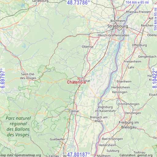
Châtenois GPS coordinates[2]
48° 16' 19.236" North, 7° 24' 3.924" East
| Map corner | latitude | longitude |
|---|---|---|
| Upper-left | 48.73786°, | 6.69797° |
| Center: | 48.27201°, | 7.40109° |
| Lower-right: | 47.80187°, | 8.10422° |
| Map W x H: | 104.1×104.1 km | = 64.7×64.7mi |
| max Lat: | 51.07786° ⇑36% North |
| Châtenois: | 48.27201° |
| min Lat: | ⇓64% South 41.3874° |
| min Long | Châtenois | max Long |
| -5.08615° | 7.40109° | 9.52242° |
| W 97.3%⇐ | ⇒2.7% E |
Elevation
Elevation of Châtenois is 188 m = 617 ft, and this is 5.7 m = 19 ft below average elevation for this country.
| Max E: |
2333 m = 7654 ft | 36.2% |
| Avg. | 193.7 m = 635 ft | |
| Châtenois | 188 m = 617 ft | |
Min E: |
-1 m = -3 ft | 63.8% |
See also: France elevation on elevation.city.
Geographical zone
Châtenois is located in North temperate zone (between Tropic of Cancer and the Arctic Circle). Distance of this North polar circle is 2033.8 km =1263.7 mi to North.| Distance of | km | miles | from Châtenois |
|---|---|---|---|
| North Pole | 4639.7 | 2883 | to North |
| Arctic Circle | 2033.8 | 1263.7 | to North |
| Tropic Cancer | 2761.4 | 1715.9 | to South |
| Equator | 5367.3 | 3335.1 | to South |


Nearby cities:
15 places around Châtenois: (largest is in red/bold)
• Bergheim
7.9 km =4.9 mi,  200°
200°
• Dambach-la-Ville
6 km =3.7 mi,  17°
17°
• Dieffenbach-au-Val
7.3 km =4.5 mi,  311°
311°
• Ebersheim
8.1 km =5 mi,  63°
63°
• Guémar
9.3 km =5.8 mi,  181°
181°
• Kintzheim
2 km =1.2 mi,  193°
193°
• Lièpvre
8.8 km =5.5 mi,  269°
269°
• Mussig
9.9 km =6.2 mi,  118°
118°
• Neubois
5.9 km =3.7 mi, 309°
• Neuve-Église
9 km =5.6 mi, 314°
• Orschwiller
3.6 km =2.2 mi, 199°
• Saint-Hippolyte
5 km =3.1 mi,  206°
206°
• Saint-Pierre-Bois
7 km =4.3 mi,  336°
336°
• Scherwiller
2.3 km =1.4 mi,  41°
41°
• Sélestat
3.7 km =2.3 mi,  107°
107°
Sources, notices
• [Note1] Compared only with cities in France existing in our database
• [Src1] Map data: © OpenStreetMap contributors (CC-BY-SA)
• [Src2] Other city data from geonames.org with taken over terms of usage.
• [Src3] Geographical zone / Annual Mean Temperature by Robert A. Rohde @ Wikipedia
