Fouchy geodata
Fouchy (Grand Est) is a populated place; located in France in Europe/Paris (GMT+2) time zone. With population of 606 people, there are 13224 cities with bigger population in this country. Compared to other cities in France, 65.1% of cities are located further ↓South; 96.3% of cities are located further ←West and 83.8% of cities have lower elevation than Fouchy. Note1
Administrative division(s):
- Level 1: Grand Est
- Level 2: Bas-Rhin
- Level 3: Arrondissement de Sélestat-Erstein
- Level 4: Fouchy


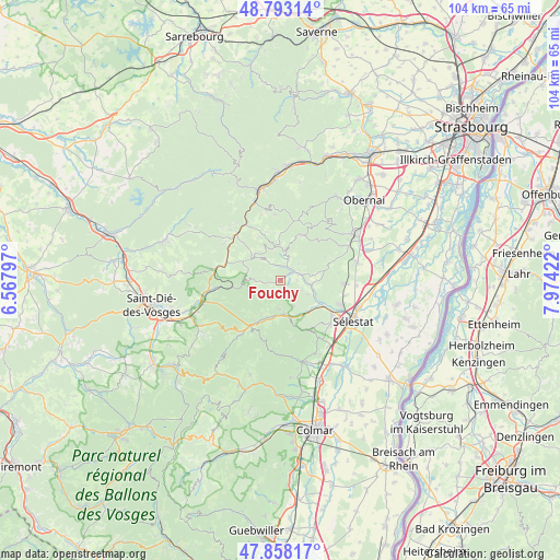
Fouchy GPS coordinates[2]
48° 19' 40.08" North, 7° 16' 15.924" East
| Map corner | latitude | longitude |
|---|---|---|
| Upper-left | 48.79314°, | 6.56797° |
| Center: | 48.3278°, | 7.27109° |
| Lower-right: | 47.85817°, | 7.97422° |
| Map W x H: | 104×104 km | = 64.6×64.6mi |
| max Lat: | 51.07786° ⇑34.9% North |
| Fouchy: | 48.3278° |
| min Lat: | ⇓65.1% South 41.3874° |
| min Long | Fouchy | max Long |
| -5.08615° | 7.27109° | 9.52242° |
| W 96.3%⇐ | ⇒3.7% E |
Elevation
Elevation of Fouchy is 332 m = 1089 ft, and this is 138.3 m = 454 ft above average elevation for this country.
| Max E: |
2333 m = 7654 ft | 16.2% |
| Fouchy | 332 m 1089 ft | |
| Avg. | 193.7 m = 635 ft | |
Min E: |
-1 m = -3 ft | 83.8% |
See also: France elevation on elevation.city.
Geographical zone
Fouchy is located in North temperate zone (between Tropic of Cancer and the Arctic Circle). Distance of this North polar circle is 2027.6 km =1259.9 mi to North.| Distance of | km | miles | from Fouchy |
|---|---|---|---|
| North Pole | 4633.5 | 2879.1 | to North |
| Arctic Circle | 2027.6 | 1259.9 | to North |
| Tropic Cancer | 2767.6 | 1719.7 | to South |
| Equator | 5373.5 | 3338.9 | to South |


Nearby cities:
15 places around Fouchy: (largest is in red/bold)
• Breitenbach
4.3 km =2.7 mi,  18°
18°
• Châtenois
11.4 km =7.1 mi,  122°
122°
• Dambach-la-Ville
11.4 km =7.1 mi,  92°
92°
• Dieffenbach-au-Val
4.3 km =2.7 mi,  108°
108°
• Lièpvre
6.3 km =3.9 mi,  172°
172°
• Maisonsgoutte
2.8 km =1.7 mi,  347°
347°
• Neubois
5.6 km =3.5 mi, 115°
• Neuve-Église
3.1 km =1.9 mi, 88°
• Rombach-le-Franc
5 km =3.1 mi,  187°
187°
• Saint-Pierre-Bois
6.8 km =4.2 mi, 88°
• Sainte-Croix-aux-Mines
7.9 km =4.9 mi,  203°
203°
• Sainte-Marie-aux-Mines
11.1 km =6.9 mi,  215°
215°
• Scherwiller
12 km =7.5 mi, 112°
• Steige
4.7 km =2.9 mi,  324°
324°
• Villé
2.9 km =1.8 mi,  54°
54°
Sources, notices
• [Note1] Compared only with cities in France existing in our database
• [Src1] Map data: © OpenStreetMap contributors (CC-BY-SA)
• [Src2] Other city data from geonames.org with taken over terms of usage.
• [Src3] Geographical zone / Annual Mean Temperature by Robert A. Rohde @ Wikipedia
