Lièpvre geodata
Lièpvre (Grand Est) is a populated place; located in France in Europe/Paris (GMT+2) time zone. With population of 1,708 people, there are 5496 cities with bigger population in this country. Compared to other cities in France, 64% of cities are located further ↓South; 96.4% of cities are located further ←West and 78.3% of cities have lower elevation than Lièpvre. Note1
Administrative division(s):
- Level 1: Grand Est
- Level 2: Haut-Rhin
- Level 3: Arrondissement de Colmar-Ribeauvillé
- Level 4: Lièpvre


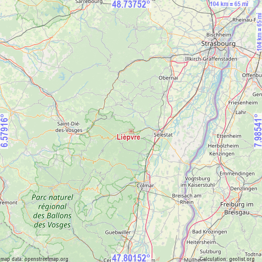
Lièpvre GPS coordinates[2]
48° 16' 17.976" North, 7° 16' 56.244" East
| Map corner | latitude | longitude |
|---|---|---|
| Upper-left | 48.73752°, | 6.57916° |
| Center: | 48.27166°, | 7.28229° |
| Lower-right: | 47.80152°, | 7.98541° |
| Map W x H: | 104.1×104.1 km | = 64.7×64.7mi |
| max Lat: | 51.07786° ⇑36% North |
| Lièpvre: | 48.27166° |
| min Lat: | ⇓64% South 41.3874° |
| min Long | Lièpvre | max Long |
| -5.08615° | 7.28229° | 9.52242° |
| W 96.4%⇐ | ⇒3.6% E |
Elevation
Elevation of Lièpvre is 274 m = 899 ft, and this is 80.3 m = 263 ft above average elevation for this country.
| Max E: |
2333 m = 7654 ft | 21.7% |
| Lièpvre | 274 m 899 ft | |
| Avg. | 193.7 m = 635 ft | |
Min E: |
-1 m = -3 ft | 78.3% |
See also: France elevation on elevation.city.
Geographical zone
Lièpvre is located in North temperate zone (between Tropic of Cancer and the Arctic Circle). Distance of this North polar circle is 2033.9 km =1263.8 mi to North.| Distance of | km | miles | from Lièpvre |
|---|---|---|---|
| North Pole | 4639.8 | 2883 | to North |
| Arctic Circle | 2033.9 | 1263.8 | to North |
| Tropic Cancer | 2761.4 | 1715.9 | to South |
| Equator | 5367.3 | 3335.1 | to South |


Nearby cities:
15 places around Lièpvre: (largest is in red/bold)
• Châtenois
8.8 km =5.5 mi,  89°
89°
• Dieffenbach-au-Val
5.9 km =3.7 mi,  33°
33°
• Fouchy
6.3 km =3.9 mi,  352°
352°
• Kintzheim
8.5 km =5.3 mi,  102°
102°
• Maisonsgoutte
9.1 km =5.7 mi, 350°
• Neubois
5.7 km =3.5 mi,  48°
48°
• Neuve-Église
6.7 km =4.2 mi,  19°
19°
• Orschwiller
8.3 km =5.2 mi,  113°
113°
• Ribeauvillé
8.9 km =5.5 mi,  162°
162°
• Rombach-le-Franc
2 km =1.2 mi,  310°
310°
• Saint-Hippolyte
8 km =5 mi,  124°
124°
• Saint-Pierre-Bois
8.7 km =5.4 mi,  42°
42°
• Sainte-Croix-aux-Mines
4.2 km =2.6 mi,  255°
255°
• Sainte-Marie-aux-Mines
7.8 km =4.8 mi,  248°
248°
• Villé
8 km =5 mi,  10°
10°
Sources, notices
• [Note1] Compared only with cities in France existing in our database
• [Src1] Map data: © OpenStreetMap contributors (CC-BY-SA)
• [Src2] Other city data from geonames.org with taken over terms of usage.
• [Src3] Geographical zone / Annual Mean Temperature by Robert A. Rohde @ Wikipedia
