Villapourçon geodata
Villapourçon (Bourgogne-Franche-Comté) is a populated place; located in France in Europe/Paris (GMT+2) time zone. With population of 536 people, there are 14480 cities with bigger population in this country. Compared to other cities in France, 55.8% of cities are located further ↑North; 67.4% of cities are located further ←West and 89.9% of cities have lower elevation than Villapourçon. Note1
Administrative division(s):
- Level 1: Bourgogne-Franche-Comté
- Level 2: Département de la Nièvre
- Level 3: Arrondissement de Château-Chinon (Ville)
- Level 4: Villapourçon


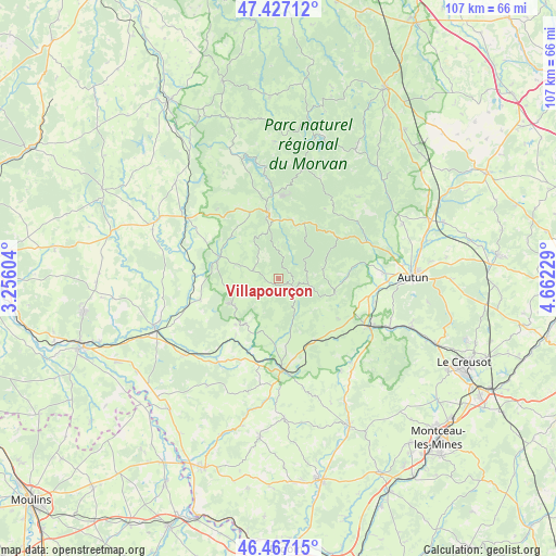
Villapourçon GPS coordinates[2]
46° 56' 57.444" North, 3° 57' 32.976" East
| Map corner | latitude | longitude |
|---|---|---|
| Upper-left | 47.42712°, | 3.25604° |
| Center: | 46.94929°, | 3.95916° |
| Lower-right: | 46.46715°, | 4.66229° |
| Map W x H: | 106.7×106.7 km | = 66.3×66.3mi |
| max Lat: | 51.07786° ⇑55.8% North |
| Villapourçon: | 46.94929° |
| min Lat: | ⇓44.2% South 41.3874° |
| min Long | Villapourçon | max Long |
| -5.08615° | 3.95916° | 9.52242° |
| W 67.4%⇐ | ⇒32.6% E |
Elevation
Elevation of Villapourçon is 424 m = 1391 ft, and this is 230.3 m = 756 ft above average elevation for this country.
| Max E: |
2333 m = 7654 ft | 10.1% |
| Villapourçon | 424 m 1391 ft | |
| Avg. | 193.7 m = 635 ft | |
Min E: |
-1 m = -3 ft | 89.9% |
See also: France elevation on elevation.city.
Geographical zone
Villapourçon is located in North temperate zone (between Tropic of Cancer and the Arctic Circle). Distance of this North polar circle is 2180.9 km =1355.1 mi to North.| Distance of | km | miles | from Villapourçon |
|---|---|---|---|
| North Pole | 4786.8 | 2974.4 | to North |
| Arctic Circle | 2180.9 | 1355.1 | to North |
| Tropic Cancer | 2614.4 | 1624.5 | to South |
| Equator | 5220.3 | 3243.7 | to South |


Nearby cities:
15 places around Villapourçon: (largest is in red/bold)
• Anost
17.8 km =11.1 mi,  36°
36°
• Arleuf
11.6 km =7.2 mi,  24°
24°
• Château-Chinon(Campagne)
11.2 km =7 mi,  353°
353°
• Château-Chinon(Ville)
13.2 km =8.2 mi, 351°
• Fours
23.3 km =14.5 mi,  230°
230°
• La Grande-Verrière
13.9 km =8.6 mi,  82°
82°
• Laizy
18.8 km =11.7 mi,  104°
104°
• Luzy
17.7 km =11 mi,  177°
177°
• Mesvres
23.5 km =14.6 mi,  113°
113°
• Moulins-Engilbert
12.1 km =7.5 mi,  291°
291°
• Saint-Honoré-les-Bains
11 km =6.8 mi,  240°
240°
• Saint-Léger-sous-Beuvray
11.2 km =7 mi, 105°
• Tavernay
22.1 km =13.7 mi,  71°
71°
• Vitry-en-Charollais
19.7 km =12.2 mi,  159°
159°
• Étang-sur-Arroux
19.8 km =12.3 mi,  117°
117°
Sources, notices
• [Note1] Compared only with cities in France existing in our database
• [Src1] Map data: © OpenStreetMap contributors (CC-BY-SA)
• [Src2] Other city data from geonames.org with taken over terms of usage.
• [Src3] Geographical zone / Annual Mean Temperature by Robert A. Rohde @ Wikipedia
