Fours geodata
Fours (Bourgogne-Franche-Comté) is a populated place; located in France in Europe/Paris (GMT+2) time zone. With population of 780 people, there are 10827 cities with bigger population in this country. Compared to other cities in France, 57% of cities are located further ↑North; 65.9% of cities are located further ←West and 72.7% of cities have lower elevation than Fours. Note1
Administrative division(s):
- Level 1: Bourgogne-Franche-Comté
- Level 2: Département de la Nièvre
- Level 3: Arrondissement de Château-Chinon (Ville)
- Level 4: Fours


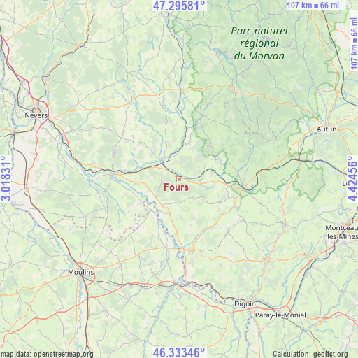
Fours GPS coordinates[2]
46° 49' 0.444" North, 3° 43' 17.148" East
| Map corner | latitude | longitude |
|---|---|---|
| Upper-left | 47.29581°, | 3.01831° |
| Center: | 46.81679°, | 3.72143° |
| Lower-right: | 46.33346°, | 4.42456° |
| Map W x H: | 107×107 km | = 66.5×66.5mi |
| max Lat: | 51.07786° ⇑57% North |
| Fours: | 46.81679° |
| min Lat: | ⇓43% South 41.3874° |
| min Long | Fours | max Long |
| -5.08615° | 3.72143° | 9.52242° |
| W 65.9%⇐ | ⇒34.1% E |
Elevation
Elevation of Fours is 234 m = 768 ft, and this is 40.3 m = 132 ft above average elevation for this country.
| Max E: |
2333 m = 7654 ft | 27.3% |
| Fours | 234 m 768 ft | |
| Avg. | 193.7 m = 635 ft | |
Min E: |
-1 m = -3 ft | 72.7% |
See also: France elevation on elevation.city.
Geographical zone
Fours is located in North temperate zone (between Tropic of Cancer and the Arctic Circle). Distance of this North polar circle is 2195.6 km =1364.3 mi to North.| Distance of | km | miles | from Fours |
|---|---|---|---|
| North Pole | 4801.5 | 2983.5 | to North |
| Arctic Circle | 2195.6 | 1364.3 | to North |
| Tropic Cancer | 2599.6 | 1615.3 | to South |
| Equator | 5205.5 | 3234.5 | to South |


Nearby cities:
15 places around Fours: (largest is in red/bold)
• Bourbon-Lancy
22 km =13.7 mi,  170°
170°
• Cercy-la-Tour
7.6 km =4.7 mi,  311°
311°
• Champvert
16.3 km =10.1 mi,  279°
279°
• Charrin
9.9 km =6.2 mi,  251°
251°
• Cossaye
19.6 km =12.2 mi, 247°
• Cronat
10.9 km =6.8 mi,  194°
194°
• Decize
19.8 km =12.3 mi,  273°
273°
• Garnat-sur-Engièvre
20.8 km =12.9 mi, 192°
• Grury
21.3 km =13.2 mi,  137°
137°
• La Machine
21.3 km =13.2 mi,  293°
293°
• Lucenay-lès-Aix
22.1 km =13.7 mi,  235°
235°
• Luzy
19.2 km =11.9 mi,  98°
98°
• Moulins-Engilbert
20.2 km =12.6 mi,  19°
19°
• Saint-Honoré-les-Bains
12.6 km =7.8 mi,  42°
42°
• Saint-Léger-des-Vignes
20.5 km =12.7 mi, 277°
Sources, notices
• [Note1] Compared only with cities in France existing in our database
• [Src1] Map data: © OpenStreetMap contributors (CC-BY-SA)
• [Src2] Other city data from geonames.org with taken over terms of usage.
• [Src3] Geographical zone / Annual Mean Temperature by Robert A. Rohde @ Wikipedia
