Luzy geodata
Luzy (Bourgogne-Franche-Comté) is a populated place; located in France in Europe/Paris (GMT+2) time zone. With population of 2,259 people, there are 4262 cities with bigger population in this country. Compared to other cities in France, 57.3% of cities are located further ↑North; 67.5% of cities are located further ←West and 77.3% of cities have lower elevation than Luzy. Note1
Administrative division(s):
- Level 1: Bourgogne-Franche-Comté
- Level 2: Département de la Nièvre
- Level 3: Arrondissement de Château-Chinon (Ville)
- Level 4: Luzy


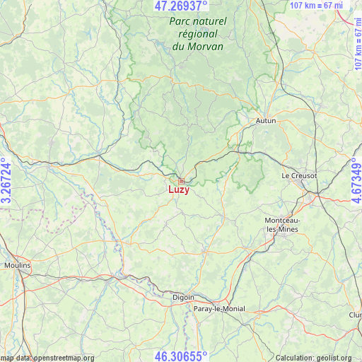
Luzy GPS coordinates[2]
46° 47' 24.396" North, 3° 58' 13.296" East
| Map corner | latitude | longitude |
|---|---|---|
| Upper-left | 47.26937°, | 3.26724° |
| Center: | 46.79011°, | 3.97036° |
| Lower-right: | 46.30655°, | 4.67349° |
| Map W x H: | 107.1×107.1 km | = 66.5×66.5mi |
| max Lat: | 51.07786° ⇑57.3% North |
| Luzy: | 46.79011° |
| min Lat: | ⇓42.7% South 41.3874° |
| min Long | Luzy | max Long |
| -5.08615° | 3.97036° | 9.52242° |
| W 67.5%⇐ | ⇒32.5% E |
Elevation
Elevation of Luzy is 266 m = 873 ft, and this is 72.3 m = 237 ft above average elevation for this country.
| Max E: |
2333 m = 7654 ft | 22.7% |
| Luzy | 266 m 873 ft | |
| Avg. | 193.7 m = 635 ft | |
Min E: |
-1 m = -3 ft | 77.3% |
See also: France elevation on elevation.city.
Geographical zone
Luzy is located in North temperate zone (between Tropic of Cancer and the Arctic Circle). Distance of this North polar circle is 2198.6 km =1366.1 mi to North.| Distance of | km | miles | from Luzy |
|---|---|---|---|
| North Pole | 4804.5 | 2985.4 | to North |
| Arctic Circle | 2198.6 | 1366.1 | to North |
| Tropic Cancer | 2596.7 | 1613.5 | to South |
| Equator | 5202.6 | 3232.7 | to South |


Nearby cities:
15 places around Luzy: (largest is in red/bold)
• Fours
19.2 km =11.9 mi,  278°
278°
• Grury
13.5 km =8.4 mi,  199°
199°
• Gueugnon
21.9 km =13.6 mi,  161°
161°
• Issy-l’Évêque
9.2 km =5.7 mi,  178°
178°
• Laizy
21.8 km =13.5 mi,  53°
53°
• Mesvres
22.2 km =13.8 mi,  68°
68°
• Neuvy-Grandchamp
22.5 km =14 mi,  186°
186°
• Saint-Honoré-les-Bains
16.1 km =10 mi,  319°
319°
• Saint-Léger-sous-Beuvray
17.8 km =11.1 mi,  33°
33°
• Toulon-sur-Arroux
16.7 km =10.4 mi,  129°
129°
• Uxeau
14.7 km =9.1 mi, 163°
• Vendenesse-sur-Arroux
19.4 km =12.1 mi, 158°
• Villapourçon
17.7 km =11 mi,  357°
357°
• Vitry-en-Charollais
6.1 km =3.8 mi,  97°
97°
• Étang-sur-Arroux
18.7 km =11.6 mi,  63°
63°
Sources, notices
• [Note1] Compared only with cities in France existing in our database
• [Src1] Map data: © OpenStreetMap contributors (CC-BY-SA)
• [Src2] Other city data from geonames.org with taken over terms of usage.
• [Src3] Geographical zone / Annual Mean Temperature by Robert A. Rohde @ Wikipedia
