Saint-Léger-sous-Beuvray geodata
Saint-Léger-sous-Beuvray (Bourgogne-Franche-Comté) is a populated place; located in France in Europe/Paris (GMT+2) time zone. With population of 525 people, there are 14719 cities with bigger population in this country. Compared to other cities in France, 56.1% of cities are located further ↑North; 68.8% of cities are located further ←West and 90.3% of cities have lower elevation than Saint-Léger-sous-Beuvray. Note1
Administrative division(s):
- Level 1: Bourgogne-Franche-Comté
- Level 2: Département de Saône-et-Loire
- Level 3: Autun
- Level 4: Saint-Léger-sous-Beuvray
Current local time in Saint-Léger-sous-Beuvray:
08:58 AM, SaturdayDifference from your time zone: hours


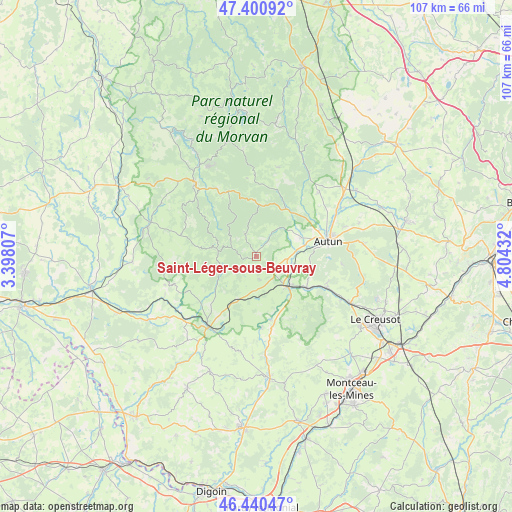
Saint-Léger-sous-Beuvray GPS coordinates[2]
46° 55' 22.26" North, 4° 6' 4.284" East
| Map corner | latitude | longitude |
|---|---|---|
| Upper-left | 47.40092°, | 3.39807° |
| Center: | 46.92285°, | 4.10119° |
| Lower-right: | 46.44047°, | 4.80432° |
| Map W x H: | 106.8×106.8 km | = 66.4×66.4mi |
| max Lat: | 51.07786° ⇑56.1% North |
| Saint-Léger-sous-Beuvray: | 46.92285° |
| min Lat: | ⇓43.9% South 41.3874° |
| min Long | Saint-Léger-so | max Long |
| -5.08615° | 4.10119° | 9.52242° |
| W 68.8%⇐ | ⇒31.2% E |
Elevation
Elevation of Saint-Léger-sous-Beuvray is 432 m = 1417 ft, and this is 238.3 m = 782 ft above average elevation for this country.
| Max E: |
2333 m = 7654 ft | 9.7% |
| Saint-Léger-sous-Beuvray | 432 m 1417 ft | |
| Avg. | 193.7 m = 635 ft | |
Min E: |
-1 m = -3 ft | 90.3% |
See also: France elevation on elevation.city.
Geographical zone
Saint-Léger-sous-Beuvray is located in North temperate zone (between Tropic of Cancer and the Arctic Circle). Distance of this North polar circle is 2183.8 km =1356.9 mi to North.| Distance of | km | miles | from Saint-Léger-sous-Beuvray |
|---|---|---|---|
| North Pole | 4789.7 | 2976.2 | to North |
| Arctic Circle | 2183.8 | 1356.9 | to North |
| Tropic Cancer | 2611.4 | 1622.6 | to South |
| Equator | 5217.3 | 3241.9 | to South |


Nearby cities:
15 places around Saint-Léger-sous-Beuvray: (largest is in red/bold)
• Anost
17.2 km =10.7 mi,  359°
359°
• Arleuf
14.7 km =9.1 mi,  336°
336°
• Autun
15.3 km =9.5 mi,  78°
78°
• Broye
15.5 km =9.6 mi,  111°
111°
• Château-Chinon(Campagne)
18.5 km =11.5 mi,  319°
319°
• La Grande-Verrière
5.5 km =3.4 mi,  32°
32°
• Laizy
7.6 km =4.7 mi,  102°
102°
• Luzy
17.8 km =11.1 mi,  213°
213°
• Mesvres
12.5 km =7.8 mi,  121°
121°
• Saint-Forgeot
17.6 km =10.9 mi,  59°
59°
• Saint-Symphorien-de-Marmagne
19.8 km =12.3 mi, 118°
• Tavernay
14.3 km =8.9 mi,  44°
44°
• Villapourçon
11.2 km =7 mi,  285°
285°
• Vitry-en-Charollais
16 km =9.9 mi,  194°
194°
• Étang-sur-Arroux
9.3 km =5.8 mi,  133°
133°
Sources, notices
• [Note1] Compared only with cities in France existing in our database
• [Src1] Map data: © OpenStreetMap contributors (CC-BY-SA)
• [Src2] Other city data from geonames.org with taken over terms of usage.
• [Src3] Geographical zone / Annual Mean Temperature by Robert A. Rohde @ Wikipedia
