Vigneux-de-Bretagne geodata
Vigneux-de-Bretagne (Pays de la Loire) is a populated place; located in France in Europe/Paris (GMT+2) time zone. With population of 5,095 people, there are 1932 cities with bigger population in this country. Compared to other cities in France, 51.1% of cities are located further ↑North; 93.7% of cities are located further →East and 76.6% of cities have higher elevation than Vigneux-de-Bretagne. Note1
Administrative division(s):
- Level 1: Pays de la Loire
- Level 2: Loire-Atlantique
- Level 3: Arrondissement of Châteaubriant-Ancenis
- Level 4: Vigneux-de-Bretagne


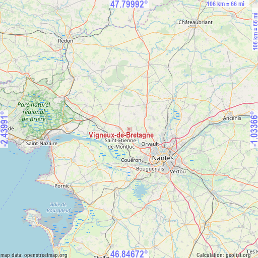
Vigneux-de-Bretagne GPS coordinates[2]
47° 19' 31.692" North, 1° 44' 12.408" West
| Map corner | latitude | longitude |
|---|---|---|
| Upper-left | 47.79992°, | -2.43991° |
| Center: | 47.32547°, | -1.73678° |
| Lower-right: | 46.84672°, | -1.03366° |
| Map W x H: | 106×106 km | = 65.9×65.9mi |
| max Lat: | 51.07786° ⇑51.1% North |
| Vigneux-de-Bretagne: | 47.32547° |
| min Lat: | ⇓48.9% South 41.3874° |
| min Long | Vigneux-de-Bret | max Long |
| -5.08615° | -1.73678° | 9.52242° |
| W 6.3%⇐ | ⇒93.7% E |
Elevation
Elevation of Vigneux-de-Bretagne is 63 m = 207 ft, and this is 130.7 m = 429 ft below average elevation for this country.
| Max E: |
2333 m = 7654 ft | 76.6% |
| Avg. | 193.7 m = 635 ft | |
| Vigneux-de-Bretagne | 63 m = 207 ft | |
Min E: |
-1 m = -3 ft | 23.4% |
See also: France elevation on elevation.city.
Geographical zone
Vigneux-de-Bretagne is located in North temperate zone (between Tropic of Cancer and the Arctic Circle). Distance of this North polar circle is 2139.1 km =1329.2 mi to North.| Distance of | km | miles | from Vigneux-de-Bretagne |
|---|---|---|---|
| North Pole | 4745 | 2948.4 | to North |
| Arctic Circle | 2139.1 | 1329.2 | to North |
| Tropic Cancer | 2656.2 | 1650.5 | to South |
| Equator | 5262.1 | 3269.7 | to South |


Nearby cities:
15 places around Vigneux-de-Bretagne: (largest is in red/bold)
• Bouvron
13.1 km =8.1 mi,  320°
320°
• Bouée
13.1 km =8.1 mi,  267°
267°
• Cordemais
11.4 km =7.1 mi,  250°
250°
• Couëron
12.3 km =7.6 mi,  174°
174°
• Fay-de-Bretagne
10.7 km =6.6 mi,  337°
337°
• Héric
11.7 km =7.3 mi,  32°
32°
• Le Pellerin
14.1 km =8.8 mi,  185°
185°
• Le Temple-de-Bretagne
3.9 km =2.4 mi, 273°
• Malville
10.2 km =6.3 mi,  291°
291°
• Notre-Dame-des-Landes
6.5 km =4 mi,  18°
18°
• Orvault
10.6 km =6.6 mi,  124°
124°
• Saint-Herblain
13.7 km =8.5 mi,  150°
150°
• Saint-Étienne-de-Montluc
6.3 km =3.9 mi,  211°
211°
• Sautron
8.6 km =5.3 mi,  144°
144°
• Treillières
8.9 km =5.5 mi,  86°
86°
Sources, notices
• [Note1] Compared only with cities in France existing in our database
• [Src1] Map data: © OpenStreetMap contributors (CC-BY-SA)
• [Src2] Other city data from geonames.org with taken over terms of usage.
• [Src3] Geographical zone / Annual Mean Temperature by Robert A. Rohde @ Wikipedia
