Fay-de-Bretagne geodata
Fay-de-Bretagne (Pays de la Loire) is a populated place; located in France in Europe/Paris (GMT+2) time zone. With population of 2,687 people, there are 3630 cities with bigger population in this country. Compared to other cities in France, 50.1% of cities are located further ↓South; 94% of cities are located further →East and 82.6% of cities have higher elevation than Fay-de-Bretagne. Note1
Administrative division(s):
- Level 1: Pays de la Loire
- Level 2: Loire-Atlantique
- Level 3: Arrondissement of Châteaubriant-Ancenis
- Level 4: Fay-de-Bretagne


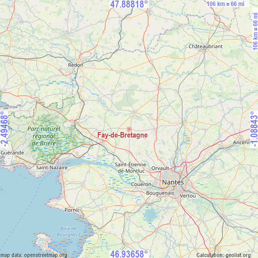
Fay-de-Bretagne GPS coordinates[2]
47° 24' 52.308" North, 1° 47' 29.58" West
| Map corner | latitude | longitude |
|---|---|---|
| Upper-left | 47.88818°, | -2.49468° |
| Center: | 47.41453°, | -1.79155° |
| Lower-right: | 46.93658°, | -1.08843° |
| Map W x H: | 105.8×105.8 km | = 65.7×65.7mi |
| max Lat: | 51.07786° ⇑49.9% North |
| Fay-de-Bretagne: | 47.41453° |
| min Lat: | ⇓50.1% South 41.3874° |
| min Long | Fay-de-Bretagne | max Long |
| -5.08615° | -1.79155° | 9.52242° |
| W 6%⇐ | ⇒94% E |
Elevation
Elevation of Fay-de-Bretagne is 48 m = 157 ft, and this is 145.7 m = 478 ft below average elevation for this country.
| Max E: |
2333 m = 7654 ft | 82.6% |
| Avg. | 193.7 m = 635 ft | |
| Fay-de-Bretagne | 48 m = 157 ft | |
Min E: |
-1 m = -3 ft | 17.4% |
See also: France elevation on elevation.city.
Geographical zone
Fay-de-Bretagne is located in North temperate zone (between Tropic of Cancer and the Arctic Circle). Distance of this North polar circle is 2129.2 km =1323 mi to North.| Distance of | km | miles | from Fay-de-Bretagne |
|---|---|---|---|
| North Pole | 4735.1 | 2942.3 | to North |
| Arctic Circle | 2129.2 | 1323 | to North |
| Tropic Cancer | 2666.1 | 1656.6 | to South |
| Equator | 5272 | 3275.9 | to South |


Nearby cities:
15 places around Fay-de-Bretagne: (largest is in red/bold)
• Blain
7.2 km =4.5 mi,  17°
17°
• Bouvron
4.2 km =2.6 mi,  274°
274°
• Bouée
13.8 km =8.6 mi,  220°
220°
• Campbon
13.3 km =8.3 mi, 269°
• Cordemais
15.2 km =9.4 mi,  205°
205°
• Héric
10.4 km =6.5 mi,  90°
90°
• La Chapelle-Launay
14.3 km =8.9 mi,  250°
250°
• La Chevallerais
10.9 km =6.8 mi,  56°
56°
• Le Gâvre
12.3 km =7.6 mi, 15°
• Le Temple-de-Bretagne
9.7 km =6 mi,  178°
178°
• Malville
8.1 km =5 mi, 220°
• Notre-Dame-des-Landes
7.3 km =4.5 mi,  121°
121°
• Quilly
13.2 km =8.2 mi,  293°
293°
• Savenay
12.8 km =8 mi,  242°
242°
• Vigneux-de-Bretagne
10.7 km =6.6 mi,  157°
157°
Sources, notices
• [Note1] Compared only with cities in France existing in our database
• [Src1] Map data: © OpenStreetMap contributors (CC-BY-SA)
• [Src2] Other city data from geonames.org with taken over terms of usage.
• [Src3] Geographical zone / Annual Mean Temperature by Robert A. Rohde @ Wikipedia
