Vignacourt geodata
Vignacourt (Hauts-de-France) is a populated place; located in France in Europe/Paris (GMT+2) time zone. With population of 2,223 people, there are 4321 cities with bigger population in this country. Compared to other cities in France, 93.6% of cities are located further ↓South; 54.5% of cities are located further →East and 51.7% of cities have higher elevation than Vignacourt. Note1
Administrative division(s):
- Level 1: Hauts-de-France
- Level 2: Somme
- Level 3: Amiens
- Level 4: Vignacourt


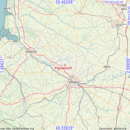
Vignacourt GPS coordinates[2]
50° 0' 44.496" North, 2° 11' 50.748" East
| Map corner | latitude | longitude |
|---|---|---|
| Upper-left | 50.46208°, | 1.49431° |
| Center: | 50.01236°, | 2.19743° |
| Lower-right: | 49.55839°, | 2.90056° |
| Map W x H: | 100.5×100.5 km | = 62.4×62.4mi |
| max Lat: | 51.07786° ⇑6.4% North |
| Vignacourt: | 50.01236° |
| min Lat: | ⇓93.6% South 41.3874° |
| min Long | Vignacourt | max Long |
| -5.08615° | 2.19743° | 9.52242° |
| W 45.5%⇐ | ⇒54.5% E |
Elevation
Elevation of Vignacourt is 126 m = 413 ft, and this is 67.7 m = 222 ft below average elevation for this country.
| Max E: |
2333 m = 7654 ft | 51.7% |
| Avg. | 193.7 m = 635 ft | |
| Vignacourt | 126 m = 413 ft | |
Min E: |
-1 m = -3 ft | 48.3% |
See also: France elevation on elevation.city.
Geographical zone
Vignacourt is located in North temperate zone (between Tropic of Cancer and the Arctic Circle). Distance of this North polar circle is 1840.3 km =1143.5 mi to North.| Distance of | km | miles | from Vignacourt |
|---|---|---|---|
| North Pole | 4446.2 | 2762.7 | to North |
| Arctic Circle | 1840.3 | 1143.5 | to North |
| Tropic Cancer | 2954.9 | 1836.1 | to South |
| Equator | 5560.9 | 3455.4 | to South |


Nearby cities:
15 places around Vignacourt: (largest is in red/bold)
• Bertangles
8.7 km =5.4 mi,  123°
123°
• Berteaucourt-les-Dames
4.8 km =3 mi,  323°
323°
• Canaples
5.1 km =3.2 mi,  17°
17°
• Domart-en-Ponthieu
8.6 km =5.3 mi, 323°
• Flesselles
4.7 km =2.9 mi,  104°
104°
• Flixecourt
8.3 km =5.2 mi,  271°
271°
• La Chaussée-Tirancourt
7.4 km =4.6 mi,  207°
207°
• Naours
6.3 km =3.9 mi,  64°
64°
• Pernois
4.6 km =2.9 mi,  350°
350°
• Picquigny
8.5 km =5.3 mi, 206°
• Saint-Léger-lès-Domart
6 km =3.7 mi, 317°
• Saint-Ouen
6.2 km =3.9 mi,  297°
297°
• Saint-Sauveur
8.3 km =5.2 mi,  173°
173°
• Saint-Vaast-en-Chaussée
5.1 km =3.2 mi,  177°
177°
• Villers-Bocage
8.7 km =5.4 mi, 100°
Sources, notices
• [Note1] Compared only with cities in France existing in our database
• [Src1] Map data: © OpenStreetMap contributors (CC-BY-SA)
• [Src2] Other city data from geonames.org with taken over terms of usage.
• [Src3] Geographical zone / Annual Mean Temperature by Robert A. Rohde @ Wikipedia
