Naours geodata
Naours (Hauts-de-France) is a populated place; located in France in Europe/Paris (GMT+2) time zone. With population of 1,139 people, there are 7895 cities with bigger population in this country. Compared to other cities in France, 93.8% of cities are located further ↓South; 53.1% of cities are located further →East and 73.6% of cities have higher elevation than Naours. Note1


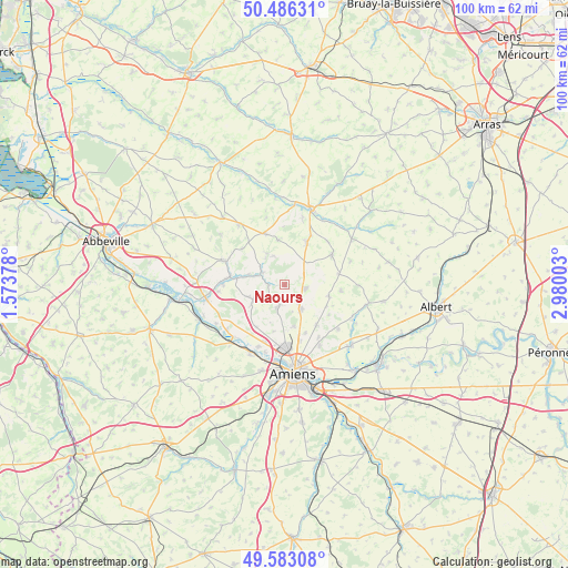
Naours GPS coordinates[2]
50° 2' 12.552" North, 2° 16' 36.876" East
| Map corner | latitude | longitude |
|---|---|---|
| Upper-left | 50.48631°, | 1.57378° |
| Center: | 50.03682°, | 2.27691° |
| Lower-right: | 49.58308°, | 2.98003° |
| Map W x H: | 100.4×100.4 km | = 62.4×62.4mi |
| max Lat: | 51.07786° ⇑6.2% North |
| Naours: | 50.03682° |
| min Lat: | ⇓93.8% South 41.3874° |
| min Long | Naours | max Long |
| -5.08615° | 2.27691° | 9.52242° |
| W 46.9%⇐ | ⇒53.1% E |
Elevation
Elevation of Naours is 70 m = 230 ft, and this is 123.7 m = 406 ft below average elevation for this country.
| Max E: |
2333 m = 7654 ft | 73.6% |
| Avg. | 193.7 m = 635 ft | |
| Naours | 70 m = 230 ft | |
Min E: |
-1 m = -3 ft | 26.4% |
See also: France elevation on elevation.city.
Geographical zone
Naours is located in North temperate zone (between Tropic of Cancer and the Arctic Circle). Distance of this North polar circle is 1837.6 km =1141.8 mi to North.| Distance of | km | miles | from Naours |
|---|---|---|---|
| North Pole | 4443.5 | 2761.1 | to North |
| Arctic Circle | 1837.6 | 1141.8 | to North |
| Tropic Cancer | 2957.7 | 1837.8 | to South |
| Equator | 5563.6 | 3457.1 | to South |


Nearby cities:
15 places around Naours: (largest is in red/bold)
• Beauquesne
9.9 km =6.2 mi,  56°
56°
• Beauval
8.8 km =5.5 mi,  26°
26°
• Bertangles
7.6 km =4.7 mi,  168°
168°
• Berteaucourt-les-Dames
8.6 km =5.3 mi,  277°
277°
• Canaples
4.7 km =2.9 mi,  297°
297°
• Candas
7.9 km =4.9 mi,  350°
350°
• Fienvillers
9.7 km =6 mi,  339°
339°
• Flesselles
4 km =2.5 mi,  196°
196°
• Pernois
6.7 km =4.2 mi,  285°
285°
• Rainneville
9 km =5.6 mi,  141°
141°
• Rubempré
8 km =5 mi,  104°
104°
• Saint-Vaast-en-Chaussée
9.5 km =5.9 mi,  215°
215°
• Talmas
3.5 km =2.2 mi, 101°
• Vignacourt
6.3 km =3.9 mi,  244°
244°
• Villers-Bocage
5.2 km =3.2 mi,  146°
146°
Sources, notices
• [Note1] Compared only with cities in France existing in our database
• [Src1] Map data: © OpenStreetMap contributors (CC-BY-SA)
• [Src2] Other city data from geonames.org with taken over terms of usage.
• [Src3] Geographical zone / Annual Mean Temperature by Robert A. Rohde @ Wikipedia
