Vielmur-sur-Agout geodata
Vielmur-sur-Agout (Occitanie) is a populated place; located in France in Europe/Paris (GMT+2) time zone. With population of 1,112 people, there are 8055 cities with bigger population in this country. Compared to other cities in France, 91.6% of cities are located further ↑North; 55.9% of cities are located further →East and 54.7% of cities have lower elevation than Vielmur-sur-Agout. Note1
Administrative division(s):
- Level 1: Occitanie
- Level 2: Tarn
- Level 3: Arrondissement de Castres
- Level 4: Vielmur-sur-Agout


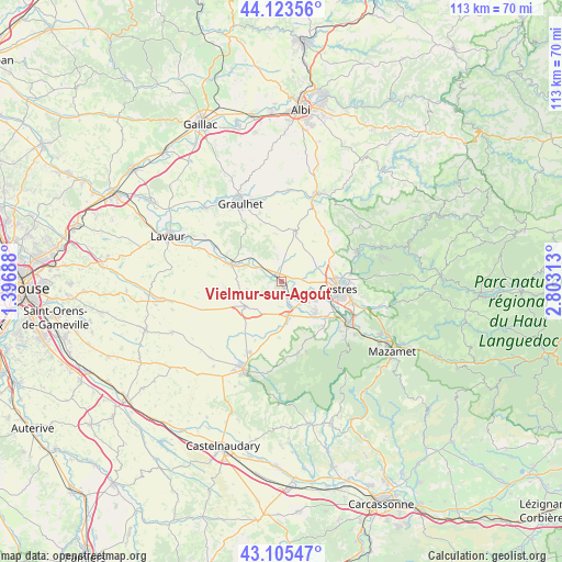
Vielmur-sur-Agout GPS coordinates[2]
43° 37' 0.012" North, 2° 6' 0" East
| Map corner | latitude | longitude |
|---|---|---|
| Upper-left | 44.12356°, | 1.39688° |
| Center: | 43.61667°, | 2.1° |
| Lower-right: | 43.10547°, | 2.80313° |
| Map W x H: | 113.2×113.2 km | = 70.3×70.3mi |
| max Lat: | 51.07786° ⇑91.6% North |
| Vielmur-sur-Agout: | 43.61667° |
| min Lat: | ⇓8.4% South 41.3874° |
| min Long | Vielmur-sur-Ago | max Long |
| -5.08615° | 2.1° | 9.52242° |
| W 44.1%⇐ | ⇒55.9% E |
Elevation
Elevation of Vielmur-sur-Agout is 149 m = 489 ft, and this is 44.7 m = 147 ft below average elevation for this country.
| Max E: |
2333 m = 7654 ft | 45.3% |
| Avg. | 193.7 m = 635 ft | |
| Vielmur-sur-Agout | 149 m = 489 ft | |
Min E: |
-1 m = -3 ft | 54.7% |
See also: France elevation on elevation.city.
Geographical zone
Vielmur-sur-Agout is located in North temperate zone (between Tropic of Cancer and the Arctic Circle). Distance of this Northern Tropic circle is 2243.8 km =1394.2 mi to South.| Distance of | km | miles | from Vielmur-sur-Agout |
|---|---|---|---|
| North Pole | 5157.3 | 3204.6 | to North |
| Arctic Circle | 2551.5 | 1585.4 | to North |
| Tropic Cancer | 2243.8 | 1394.2 | to South |
| Equator | 4849.7 | 3013.5 | to South |


Nearby cities:
15 places around Vielmur-sur-Agout: (largest is in red/bold)
• Cambounet-sur-le-Sor
4.7 km =2.9 mi,  161°
161°
• Castres
11.3 km =7 mi,  96°
96°
• Damiatte
10.7 km =6.6 mi,  291°
291°
• Fréjeville
3.4 km =2.1 mi, 101°
• Lautrec
10.4 km =6.5 mi,  17°
17°
• Lempaut
10.3 km =6.4 mi,  195°
195°
• Navès
11.7 km =7.3 mi,  119°
119°
• Puylaurens
8.6 km =5.3 mi,  234°
234°
• Saint-Germain-des-Prés
6.7 km =4.2 mi, 204°
• Saint-Paul-Cap-de-Joux
10.6 km =6.6 mi, 289°
• Saïx
7.7 km =4.8 mi, 118°
• Serviès
7.5 km =4.7 mi,  310°
310°
• Soual
7 km =4.3 mi,  168°
168°
• Sémalens
2.9 km =1.8 mi, 160°
• Viviers-lès-Montagnes
9.3 km =5.8 mi,  138°
138°
Sources, notices
• [Note1] Compared only with cities in France existing in our database
• [Src1] Map data: © OpenStreetMap contributors (CC-BY-SA)
• [Src2] Other city data from geonames.org with taken over terms of usage.
• [Src3] Geographical zone / Annual Mean Temperature by Robert A. Rohde @ Wikipedia
