Courpière geodata
Courpière (Auvergne-Rhône-Alpes) is a populated place; located in France in Europe/Paris (GMT+2) time zone. With population of 4,918 people, there are 2013 cities with bigger population in this country. Compared to other cities in France, 69.9% of cities are located further ↑North; 64.6% of cities are located further ←West and 82.6% of cities have lower elevation than Courpière. Note1
Administrative division(s):
- Level 1: Auvergne-Rhône-Alpes
- Level 2: Département du Puy-de-Dôme
- Level 3: Arrondissement de Thiers
- Level 4: Courpière


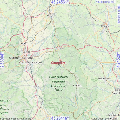
Courpière GPS coordinates[2]
45° 45' 24.804" North, 3° 32' 31.776" East
| Map corner | latitude | longitude |
|---|---|---|
| Upper-left | 46.24531°, | 2.83904° |
| Center: | 45.75689°, | 3.54216° |
| Lower-right: | 45.26416°, | 4.24529° |
| Map W x H: | 109.1×109.1 km | = 67.8×67.8mi |
| max Lat: | 51.07786° ⇑69.9% North |
| Courpière: | 45.75689° |
| min Lat: | ⇓30.1% South 41.3874° |
| min Long | Courpière | max Long |
| -5.08615° | 3.54216° | 9.52242° |
| W 64.6%⇐ | ⇒35.4% E |
Elevation
Elevation of Courpière is 317 m = 1040 ft, and this is 123.3 m = 405 ft above average elevation for this country.
| Max E: |
2333 m = 7654 ft | 17.4% |
| Courpière | 317 m 1040 ft | |
| Avg. | 193.7 m = 635 ft | |
Min E: |
-1 m = -3 ft | 82.6% |
See also: France elevation on elevation.city.
Geographical zone
Courpière is located in North temperate zone (between Tropic of Cancer and the Arctic Circle). Distance of this North polar circle is 2313.5 km =1437.5 mi to North.| Distance of | km | miles | from Courpière |
|---|---|---|---|
| North Pole | 4919.4 | 3056.8 | to North |
| Arctic Circle | 2313.5 | 1437.5 | to North |
| Tropic Cancer | 2481.8 | 1542.1 | to South |
| Equator | 5087.7 | 3161.3 | to South |


Nearby cities:
15 places around Courpière: (largest is in red/bold)
• Augerolles
6.9 km =4.3 mi,  123°
123°
• Celles-sur-Durolle
13.4 km =8.3 mi,  32°
32°
• Cunlhat
14 km =8.7 mi,  174°
174°
• Escoutoux
7.1 km =4.4 mi,  13°
13°
• La Monnerie-le-Montel
13.5 km =8.4 mi,  19°
19°
• Moissat Haut
14.8 km =9.2 mi,  278°
278°
• Olliergues
11.7 km =7.3 mi,  141°
141°
• Peschadoires
8.6 km =5.3 mi,  333°
333°
• Ravel
11.6 km =7.2 mi, 281°
• Saint-Dier-d’Auvergne
10.1 km =6.3 mi,  207°
207°
• Sermentizon
3.3 km =2.1 mi, 280°
• Thiers
11.1 km =6.9 mi,  2°
2°
• Tours-sur-Meymont
9.8 km =6.1 mi,  164°
164°
• Vollore-Ville
5.5 km =3.4 mi,  55°
55°
• Égliseneuve-près-Billom
12.4 km =7.7 mi,  251°
251°
Sources, notices
• [Note1] Compared only with cities in France existing in our database
• [Src1] Map data: © OpenStreetMap contributors (CC-BY-SA)
• [Src2] Other city data from geonames.org with taken over terms of usage.
• [Src3] Geographical zone / Annual Mean Temperature by Robert A. Rohde @ Wikipedia
