Vollore-Ville geodata
Vollore-Ville (Auvergne-Rhône-Alpes) is a populated place; located in France in Europe/Paris (GMT+2) time zone. With population of 725 people, there are 11465 cities with bigger population in this country. Compared to other cities in France, 69.5% of cities are located further ↑North; 65.1% of cities are located further ←West and 94.2% of cities have lower elevation than Vollore-Ville. Note1
Administrative division(s):
- Level 1: Auvergne-Rhône-Alpes
- Level 2: Département du Puy-de-Dôme
- Level 3: Arrondissement de Thiers
- Level 4: Vollore-Ville


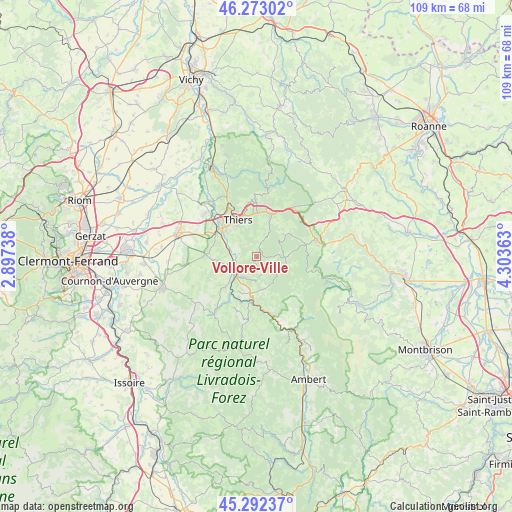
Vollore-Ville GPS coordinates[2]
45° 47' 5.46" North, 3° 36' 1.8" East
| Map corner | latitude | longitude |
|---|---|---|
| Upper-left | 46.27302°, | 2.89738° |
| Center: | 45.78485°, | 3.6005° |
| Lower-right: | 45.29237°, | 4.30363° |
| Map W x H: | 109×109 km | = 67.7×67.7mi |
| max Lat: | 51.07786° ⇑69.5% North |
| Vollore-Ville: | 45.78485° |
| min Lat: | ⇓30.5% South 41.3874° |
| min Long | Vollore-Ville | max Long |
| -5.08615° | 3.6005° | 9.52242° |
| W 65.1%⇐ | ⇒34.9% E |
Elevation
Elevation of Vollore-Ville is 549 m = 1801 ft, and this is 355.3 m = 1166 ft above average elevation for this country.
| Max E: |
2333 m = 7654 ft | 5.8% |
| Vollore-Ville | 549 m 1801 ft | |
| Avg. | 193.7 m = 635 ft | |
Min E: |
-1 m = -3 ft | 94.2% |
See also: France elevation on elevation.city.
Geographical zone
Vollore-Ville is located in North temperate zone (between Tropic of Cancer and the Arctic Circle). Distance of this North polar circle is 2310.4 km =1435.6 mi to North.| Distance of | km | miles | from Vollore-Ville |
|---|---|---|---|
| North Pole | 4916.3 | 3054.8 | to North |
| Arctic Circle | 2310.4 | 1435.6 | to North |
| Tropic Cancer | 2484.9 | 1544 | to South |
| Equator | 5090.8 | 3163.3 | to South |


Nearby cities:
15 places around Vollore-Ville: (largest is in red/bold)
• Arconsat
14.5 km =9 mi,  37°
37°
• Augerolles
7 km =4.3 mi,  169°
169°
• Celles-sur-Durolle
8.6 km =5.3 mi,  18°
18°
• Chabreloche
12.8 km =8 mi, 35°
• Courpière
5.5 km =3.4 mi,  235°
235°
• Escoutoux
4.8 km =3 mi,  323°
323°
• La Monnerie-le-Montel
9.6 km =6 mi,  0°
0°
• Noirétable
13 km =8.1 mi,  74°
74°
• Olliergues
12.6 km =7.8 mi, 167°
• Palladuc
13.5 km =8.4 mi,  9°
9°
• Peschadoires
9.5 km =5.9 mi,  298°
298°
• Saint-Rémy-sur-Durolle
11.5 km =7.1 mi,  356°
356°
• Sermentizon
8.2 km =5.1 mi,  251°
251°
• Thiers
9 km =5.6 mi,  332°
332°
• Tours-sur-Meymont
12.7 km =7.9 mi,  188°
188°
Sources, notices
• [Note1] Compared only with cities in France existing in our database
• [Src1] Map data: © OpenStreetMap contributors (CC-BY-SA)
• [Src2] Other city data from geonames.org with taken over terms of usage.
• [Src3] Geographical zone / Annual Mean Temperature by Robert A. Rohde @ Wikipedia
