Vert-le-Petit geodata
Vert-le-Petit (Île-de-France) is a populated place; located in France in Europe/Paris (GMT+2) time zone. With population of 2,561 people, there are 3802 cities with bigger population in this country. Compared to other cities in France, 69.6% of cities are located further ↓South; 51.6% of cities are located further →East and 74.6% of cities have higher elevation than Vert-le-Petit. Note1
Administrative division(s):
- Level 1: Île-de-France
- Level 2: Département de l'Essonne
- Level 3: Arrondissement d'Évry
- Level 4: Vert-le-Petit


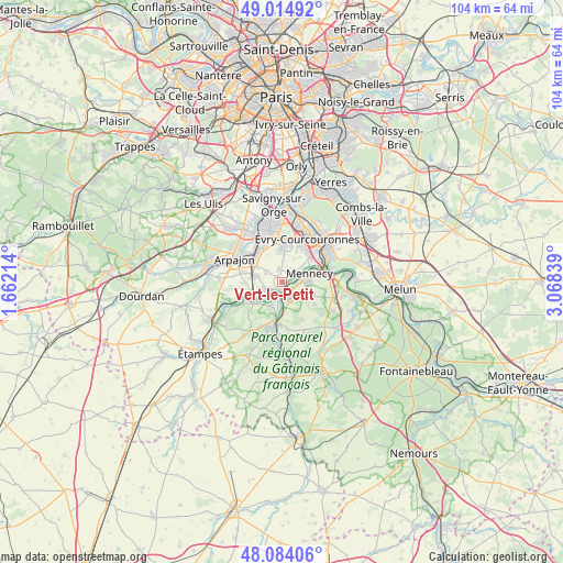
Vert-le-Petit GPS coordinates[2]
48° 33' 5.868" North, 2° 21' 54.936" East
| Map corner | latitude | longitude |
|---|---|---|
| Upper-left | 49.01492°, | 1.66214° |
| Center: | 48.55163°, | 2.36526° |
| Lower-right: | 48.08406°, | 3.06839° |
| Map W x H: | 103.5×103.5 km | = 64.3×64.3mi |
| max Lat: | 51.07786° ⇑30.4% North |
| Vert-le-Petit: | 48.55163° |
| min Lat: | ⇓69.6% South 41.3874° |
| min Long | Vert-le-Petit | max Long |
| -5.08615° | 2.36526° | 9.52242° |
| W 48.4%⇐ | ⇒51.6% E |
Elevation
Elevation of Vert-le-Petit is 68 m = 223 ft, and this is 125.7 m = 412 ft below average elevation for this country.
| Max E: |
2333 m = 7654 ft | 74.6% |
| Avg. | 193.7 m = 635 ft | |
| Vert-le-Petit | 68 m = 223 ft | |
Min E: |
-1 m = -3 ft | 25.4% |
See also: France elevation on elevation.city.
Geographical zone
Vert-le-Petit is located in North temperate zone (between Tropic of Cancer and the Arctic Circle). Distance of this North polar circle is 2002.7 km =1244.4 mi to North.| Distance of | km | miles | from Vert-le-Petit |
|---|---|---|---|
| North Pole | 4608.6 | 2863.7 | to North |
| Arctic Circle | 2002.7 | 1244.4 | to North |
| Tropic Cancer | 2792.5 | 1735.2 | to South |
| Equator | 5398.4 | 3354.4 | to South |


Nearby cities:
15 places around Vert-le-Petit: (largest is in red/bold)
• Ballancourt-sur-Essonne
3.3 km =2.1 mi,  152°
152°
• Baulne
6.5 km =4 mi,  181°
181°
• Bondoufle
6.9 km =4.3 mi,  7°
7°
• Bouray-sur-Juine
6 km =3.7 mi,  233°
233°
• Cheptainville
6.5 km =4 mi,  269°
269°
• Chevannes
6.2 km =3.9 mi,  110°
110°
• Fontenay-le-Vicomte
2.5 km =1.6 mi,  100°
100°
• Itteville
4.3 km =2.7 mi,  201°
201°
• Leudeville
3.2 km =2 mi,  299°
299°
• Marolles-en-Hurepoix
5 km =3.1 mi,  283°
283°
• Mennecy
6.1 km =3.8 mi,  71°
71°
• Ormoy
6.9 km =4.3 mi, 67°
• Saint-Vrain
2.5 km =1.6 mi,  247°
247°
• Vert-le-Grand
2.3 km =1.4 mi,  346°
346°
• Écharcon
4.1 km =2.5 mi,  53°
53°
Sources, notices
• [Note1] Compared only with cities in France existing in our database
• [Src1] Map data: © OpenStreetMap contributors (CC-BY-SA)
• [Src2] Other city data from geonames.org with taken over terms of usage.
• [Src3] Geographical zone / Annual Mean Temperature by Robert A. Rohde @ Wikipedia
