Itteville geodata
Itteville (Île-de-France) is a populated place; located in France in Europe/Paris (GMT+2) time zone. With population of 5,650 people, there are 1757 cities with bigger population in this country. Compared to other cities in France, 68.7% of cities are located further ↓South; 52% of cities are located further →East and 72.3% of cities have higher elevation than Itteville. Note1
Administrative division(s):
- Level 1: Île-de-France
- Level 2: Département de l'Essonne
- Level 3: Arrondissement d'Étampes
- Level 4: Itteville


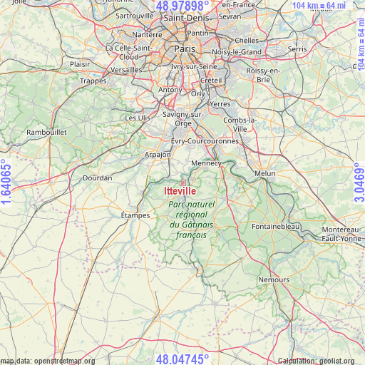
Itteville GPS coordinates[2]
48° 30' 55.296" North, 2° 20' 37.572" East
| Map corner | latitude | longitude |
|---|---|---|
| Upper-left | 48.97898°, | 1.64065° |
| Center: | 48.51536°, | 2.34377° |
| Lower-right: | 48.04745°, | 3.0469° |
| Map W x H: | 103.6×103.6 km | = 64.4×64.4mi |
| max Lat: | 51.07786° ⇑31.3% North |
| Itteville: | 48.51536° |
| min Lat: | ⇓68.7% South 41.3874° |
| min Long | Itteville | max Long |
| -5.08615° | 2.34377° | 9.52242° |
| W 48%⇐ | ⇒52% E |
Elevation
Elevation of Itteville is 73 m = 240 ft, and this is 120.7 m = 396 ft below average elevation for this country.
| Max E: |
2333 m = 7654 ft | 72.3% |
| Avg. | 193.7 m = 635 ft | |
| Itteville | 73 m = 240 ft | |
Min E: |
-1 m = -3 ft | 27.7% |
See also: France elevation on elevation.city.
Geographical zone
Itteville is located in North temperate zone (between Tropic of Cancer and the Arctic Circle). Distance of this North polar circle is 2006.8 km =1247 mi to North.| Distance of | km | miles | from Itteville |
|---|---|---|---|
| North Pole | 4612.7 | 2866.2 | to North |
| Arctic Circle | 2006.8 | 1247 | to North |
| Tropic Cancer | 2788.5 | 1732.7 | to South |
| Equator | 5394.4 | 3351.9 | to South |


Nearby cities:
15 places around Itteville: (largest is in red/bold)
• Ballancourt-sur-Essonne
3.3 km =2.1 mi,  70°
70°
• Baulne
2.8 km =1.7 mi,  151°
151°
• Bouray-sur-Juine
3.3 km =2.1 mi,  278°
278°
• Cerny
4.3 km =2.7 mi,  195°
195°
• Cheptainville
6.3 km =3.9 mi,  308°
308°
• Fontenay-le-Vicomte
5.4 km =3.4 mi,  48°
48°
• Guigneville-sur-Essonne
4.6 km =2.9 mi,  169°
169°
• Janville-sur-Juine
5.4 km =3.4 mi,  267°
267°
• La Ferté-Alais
3.6 km =2.2 mi,  175°
175°
• Lardy
5.2 km =3.2 mi, 273°
• Leudeville
5.8 km =3.6 mi,  347°
347°
• Marolles-en-Hurepoix
6.2 km =3.9 mi,  327°
327°
• Mondeville
6 km =3.7 mi,  116°
116°
• Saint-Vrain
3.2 km =2 mi, 345°
• Vert-le-Petit
4.3 km =2.7 mi,  21°
21°
Sources, notices
• [Note1] Compared only with cities in France existing in our database
• [Src1] Map data: © OpenStreetMap contributors (CC-BY-SA)
• [Src2] Other city data from geonames.org with taken over terms of usage.
• [Src3] Geographical zone / Annual Mean Temperature by Robert A. Rohde @ Wikipedia
