Verquin geodata
Verquin (Hauts-de-France) is a populated place; located in France in Europe/Paris (GMT+2) time zone. With population of 3,185 people, there are 3059 cities with bigger population in this country. Compared to other cities in France, 97.3% of cities are located further ↓South; 52.6% of cities are located further ←West and 83.4% of cities have higher elevation than Verquin. Note1
Administrative division(s):
- Level 1: Hauts-de-France
- Level 2: Pas-de-Calais
- Level 3: Arrondissement de Béthune
- Level 4: Verquin


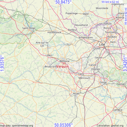
Verquin GPS coordinates[2]
50° 30' 8.64" North, 2° 38' 19.968" East
| Map corner | latitude | longitude |
|---|---|---|
| Upper-left | 50.9475°, | 1.93576° |
| Center: | 50.5024°, | 2.63888° |
| Lower-right: | 50.05306°, | 3.34201° |
| Map W x H: | 99.5×99.5 km | = 61.8×61.8mi |
| max Lat: | 51.07786° ⇑2.7% North |
| Verquin: | 50.5024° |
| min Lat: | ⇓97.3% South 41.3874° |
| min Long | Verquin | max Long |
| -5.08615° | 2.63888° | 9.52242° |
| W 52.6%⇐ | ⇒47.4% E |
Elevation
Elevation of Verquin is 46 m = 151 ft, and this is 147.7 m = 485 ft below average elevation for this country.
| Max E: |
2333 m = 7654 ft | 83.4% |
| Avg. | 193.7 m = 635 ft | |
| Verquin | 46 m = 151 ft | |
Min E: |
-1 m = -3 ft | 16.6% |
See also: France elevation on elevation.city.
Geographical zone
Verquin is located in North temperate zone (between Tropic of Cancer and the Arctic Circle). Distance of this North polar circle is 1785.8 km =1109.6 mi to North.| Distance of | km | miles | from Verquin |
|---|---|---|---|
| North Pole | 4391.7 | 2728.9 | to North |
| Arctic Circle | 1785.8 | 1109.6 | to North |
| Tropic Cancer | 3009.4 | 1870 | to South |
| Equator | 5615.3 | 3489.2 | to South |


Nearby cities:
15 places around Verquin: (largest is in red/bold)
• Annezin
3.6 km =2.2 mi,  335°
335°
• Beuvry
3.7 km =2.3 mi,  64°
64°
• Béthune
3 km =1.9 mi,  1°
1°
• Essars
5.5 km =3.4 mi,  20°
20°
• Fouquereuil
3.3 km =2.1 mi,  303°
303°
• Fouquières-lès-Béthune
2.5 km =1.6 mi,  305°
305°
• Gosnay
3.6 km =2.2 mi,  276°
276°
• Hesdigneul-lès-Béthune
3.5 km =2.2 mi,  268°
268°
• Houchin
2.6 km =1.6 mi,  211°
211°
• Labourse
3 km =1.9 mi,  97°
97°
• Nœux-les-Mines
2.9 km =1.8 mi,  137°
137°
• Ruitz
5.3 km =3.3 mi,  221°
221°
• Sailly-Labourse
4.1 km =2.5 mi,  91°
91°
• Vaudricourt
1 km =0.6 mi,  259°
259°
• Vendin-lès-Béthune
5 km =3.1 mi,  327°
327°
Sources, notices
• [Note1] Compared only with cities in France existing in our database
• [Src1] Map data: © OpenStreetMap contributors (CC-BY-SA)
• [Src2] Other city data from geonames.org with taken over terms of usage.
• [Src3] Geographical zone / Annual Mean Temperature by Robert A. Rohde @ Wikipedia
