Labourse geodata
Labourse (Hauts-de-France) is a populated place; located in France in Europe/Paris (GMT+2) time zone. With population of 2,063 people, there are 4658 cities with bigger population in this country. Compared to other cities in France, 97.3% of cities are located further ↓South; 53.2% of cities are located further ←West and 92.4% of cities have higher elevation than Labourse. Note1
Administrative division(s):
- Level 1: Hauts-de-France
- Level 2: Pas-de-Calais
- Level 3: Arrondissement de Béthune
- Level 4: Labourse


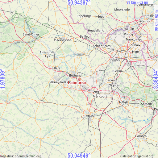
Labourse GPS coordinates[2]
50° 29' 55.788" North, 2° 40' 52.356" East
| Map corner | latitude | longitude |
|---|---|---|
| Upper-left | 50.94397°, | 1.97809° |
| Center: | 50.49883°, | 2.68121° |
| Lower-right: | 50.04946°, | 3.38434° |
| Map W x H: | 99.5×99.5 km | = 61.8×61.8mi |
| max Lat: | 51.07786° ⇑2.7% North |
| Labourse: | 50.49883° |
| min Lat: | ⇓97.3% South 41.3874° |
| min Long | Labourse | max Long |
| -5.08615° | 2.68121° | 9.52242° |
| W 53.2%⇐ | ⇒46.8% E |
Elevation
Elevation of Labourse is 24 m = 79 ft, and this is 169.7 m = 557 ft below average elevation for this country.
| Max E: |
2333 m = 7654 ft | 92.4% |
| Avg. | 193.7 m = 635 ft | |
| Labourse | 24 m = 79 ft | |
Min E: |
-1 m = -3 ft | 7.6% |
See also: France elevation on elevation.city.
Geographical zone
Labourse is located in North temperate zone (between Tropic of Cancer and the Arctic Circle). Distance of this North polar circle is 1786.2 km =1109.9 mi to North.| Distance of | km | miles | from Labourse |
|---|---|---|---|
| North Pole | 4392.1 | 2729.1 | to North |
| Arctic Circle | 1786.2 | 1109.9 | to North |
| Tropic Cancer | 3009 | 1869.7 | to South |
| Equator | 5614.9 | 3488.9 | to South |


Nearby cities:
15 places around Labourse: (largest is in red/bold)
• Annequin
2.8 km =1.7 mi,  75°
75°
• Beuvry
2 km =1.2 mi,  8°
8°
• Béthune
4.5 km =2.8 mi,  319°
319°
• Cambrin
4.4 km =2.7 mi,  74°
74°
• Cuinchy
5.2 km =3.2 mi, 66°
• Essars
5.6 km =3.5 mi,  349°
349°
• Fouquières-lès-Béthune
5.4 km =3.4 mi,  290°
290°
• Houchin
4.7 km =2.9 mi,  247°
247°
• Mazingarbe
3.9 km =2.4 mi,  141°
141°
• Noyelles-lès-Vermelles
3.3 km =2.1 mi,  107°
107°
• Nœux-les-Mines
2 km =1.2 mi,  210°
210°
• Sailly-Labourse
1.2 km =0.7 mi, 76°
• Vaudricourt
4 km =2.5 mi,  273°
273°
• Vermelles
4.8 km =3 mi,  102°
102°
• Verquin
3 km =1.9 mi,  277°
277°
Sources, notices
• [Note1] Compared only with cities in France existing in our database
• [Src1] Map data: © OpenStreetMap contributors (CC-BY-SA)
• [Src2] Other city data from geonames.org with taken over terms of usage.
• [Src3] Geographical zone / Annual Mean Temperature by Robert A. Rohde @ Wikipedia
