Verneuil-sur-Seine geodata
Verneuil-sur-Seine (Île-de-France) is a populated place; located in France in Europe/Paris (GMT+2) time zone. With population of 16,790 people, there are 564 cities with bigger population in this country. Compared to other cities in France, 79.1% of cities are located further ↓South; 57.6% of cities are located further →East and 77.8% of cities have higher elevation than Verneuil-sur-Seine. Note1
Administrative division(s):
- Level 1: Île-de-France
- Level 2: Yvelines
- Level 3: Arrondissement de Saint-Germain-en-Laye
- Level 4: Verneuil-sur-Seine


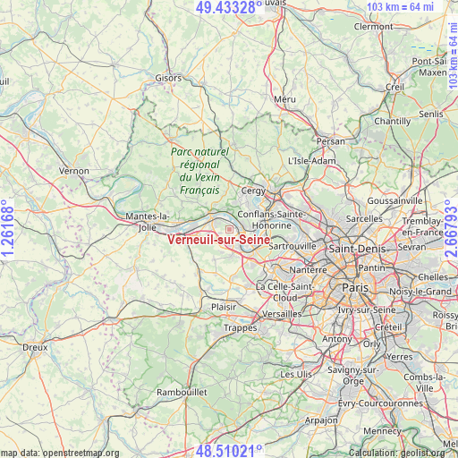
Verneuil-sur-Seine GPS coordinates[2]
48° 58' 25.968" North, 1° 57' 53.28" East
| Map corner | latitude | longitude |
|---|---|---|
| Upper-left | 49.43328°, | 1.26168° |
| Center: | 48.97388°, | 1.9648° |
| Lower-right: | 48.51021°, | 2.66793° |
| Map W x H: | 102.6×102.6 km | = 63.8×63.8mi |
| max Lat: | 51.07786° ⇑20.9% North |
| Verneuil-sur-Seine: | 48.97388° |
| min Lat: | ⇓79.1% South 41.3874° |
| min Long | Verneuil-sur-Se | max Long |
| -5.08615° | 1.9648° | 9.52242° |
| W 42.4%⇐ | ⇒57.6% E |
Elevation
Elevation of Verneuil-sur-Seine is 60 m = 197 ft, and this is 133.7 m = 439 ft below average elevation for this country.
| Max E: |
2333 m = 7654 ft | 77.8% |
| Avg. | 193.7 m = 635 ft | |
| Verneuil-sur-Seine | 60 m = 197 ft | |
Min E: |
-1 m = -3 ft | 22.2% |
See also: France elevation on elevation.city.
Geographical zone
Verneuil-sur-Seine is located in North temperate zone (between Tropic of Cancer and the Arctic Circle). Distance of this North polar circle is 1955.8 km =1215.3 mi to North.| Distance of | km | miles | from Verneuil-sur-Seine |
|---|---|---|---|
| North Pole | 4561.7 | 2834.5 | to North |
| Arctic Circle | 1955.8 | 1215.3 | to North |
| Tropic Cancer | 2839.5 | 1764.4 | to South |
| Equator | 5445.4 | 3383.6 | to South |


Nearby cities:
15 places around Verneuil-sur-Seine: (largest is in red/bold)
• Bouafle
4.8 km =3 mi,  257°
257°
• Chanteloup-les-Vignes
5 km =3.1 mi,  87°
87°
• Chapet
2.4 km =1.5 mi,  250°
250°
• Ecquevilly
3.9 km =2.4 mi,  231°
231°
• Les Mureaux
4.5 km =2.8 mi,  296°
296°
• Menucourt
6.2 km =3.9 mi,  10°
10°
• Meulan-en-Yvelines
5.7 km =3.5 mi,  311°
311°
• Morainvilliers
5.4 km =3.4 mi,  202°
202°
• Médan
3 km =1.9 mi,  133°
133°
• Orgeval
5.9 km =3.7 mi,  170°
170°
• Triel-sur-Seine
3.1 km =1.9 mi,  81°
81°
• Vaux-sur-Seine
4.3 km =2.7 mi,  4°
4°
• Vernouillet
1.2 km =0.7 mi,  102°
102°
• Villennes-sur-Seine
4.1 km =2.5 mi,  151°
151°
• Évecquemont
4.7 km =2.9 mi,  341°
341°
Sources, notices
• [Note1] Compared only with cities in France existing in our database
• [Src1] Map data: © OpenStreetMap contributors (CC-BY-SA)
• [Src2] Other city data from geonames.org with taken over terms of usage.
• [Src3] Geographical zone / Annual Mean Temperature by Robert A. Rohde @ Wikipedia
