Velars-sur-Ouche geodata
Velars-sur-Ouche (Bourgogne-Franche-Comté) is a populated place; located in France in Europe/Paris (GMT+2) time zone. With population of 1,583 people, there are 5895 cities with bigger population in this country. Compared to other cities in France, 51.2% of cities are located further ↑North; 76.6% of cities are located further ←West and 78.1% of cities have lower elevation than Velars-sur-Ouche. Note1
Administrative division(s):
- Level 1: Bourgogne-Franche-Comté
- Level 2: Département de la Côte-d'Or
- Level 3: Arrondissement de Dijon
- Level 4: Velars-sur-Ouche


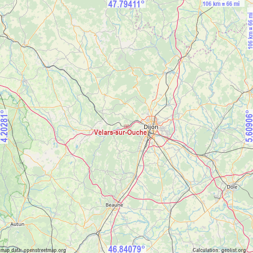
Velars-sur-Ouche GPS coordinates[2]
47° 19' 10.56" North, 4° 54' 21.384" East
| Map corner | latitude | longitude |
|---|---|---|
| Upper-left | 47.79411°, | 4.20281° |
| Center: | 47.3196°, | 4.90594° |
| Lower-right: | 46.84079°, | 5.60906° |
| Map W x H: | 106×106 km | = 65.9×65.9mi |
| max Lat: | 51.07786° ⇑51.2% North |
| Velars-sur-Ouche: | 47.3196° |
| min Lat: | ⇓48.8% South 41.3874° |
| min Long | Velars-sur-Ouch | max Long |
| -5.08615° | 4.90594° | 9.52242° |
| W 76.6%⇐ | ⇒23.4% E |
Elevation
Elevation of Velars-sur-Ouche is 273 m = 896 ft, and this is 79.3 m = 260 ft above average elevation for this country.
| Max E: |
2333 m = 7654 ft | 21.9% |
| Velars-sur-Ouche | 273 m 896 ft | |
| Avg. | 193.7 m = 635 ft | |
Min E: |
-1 m = -3 ft | 78.1% |
See also: France elevation on elevation.city.
Geographical zone
Velars-sur-Ouche is located in North temperate zone (between Tropic of Cancer and the Arctic Circle). Distance of this North polar circle is 2139.7 km =1329.5 mi to North.| Distance of | km | miles | from Velars-sur-Ouche |
|---|---|---|---|
| North Pole | 4745.6 | 2948.8 | to North |
| Arctic Circle | 2139.7 | 1329.5 | to North |
| Tropic Cancer | 2655.5 | 1650.1 | to South |
| Equator | 5261.4 | 3269.3 | to South |


Nearby cities:
15 places around Velars-sur-Ouche: (largest is in red/bold)
• Chenôve
8 km =5 mi,  111°
111°
• Corcelles-les-Monts
3.8 km =2.4 mi,  136°
136°
• Couchey
8.8 km =5.5 mi, 138°
• Daix
7.9 km =4.9 mi,  64°
64°
• Dijon
8.4 km =5.2 mi,  92°
92°
• Fixin
9.7 km =6 mi,  148°
148°
• Fleurey-sur-Ouche
3.6 km =2.2 mi,  256°
256°
• Fontaine-lès-Dijon
9 km =5.6 mi,  73°
73°
• Hauteville-lès-Dijon
8.4 km =5.2 mi,  52°
52°
• Marsannay-la-Côte
8.3 km =5.2 mi,  130°
130°
• Mâlain
8.1 km =5 mi,  275°
275°
• Perrigny-lès-Dijon
9.6 km =6 mi, 127°
• Plombières-lès-Dijon
4.8 km =3 mi, 71°
• Sainte-Marie-sur-Ouche
9 km =5.6 mi,  246°
246°
• Talant
8 km =5 mi,  76°
76°
Sources, notices
• [Note1] Compared only with cities in France existing in our database
• [Src1] Map data: © OpenStreetMap contributors (CC-BY-SA)
• [Src2] Other city data from geonames.org with taken over terms of usage.
• [Src3] Geographical zone / Annual Mean Temperature by Robert A. Rohde @ Wikipedia
