Mâlain geodata
Mâlain (Bourgogne-Franche-Comté) is a populated place; located in France in Europe/Paris (GMT+2) time zone. With population of 674 people, there are 12156 cities with bigger population in this country. Compared to other cities in France, 51.1% of cities are located further ↑North; 75% of cities are located further ←West and 84.8% of cities have lower elevation than Mâlain. Note1
Administrative division(s):
- Level 1: Bourgogne-Franche-Comté
- Level 2: Département de la Côte-d'Or
- Level 3: Arrondissement de Dijon
- Level 4: Mâlain


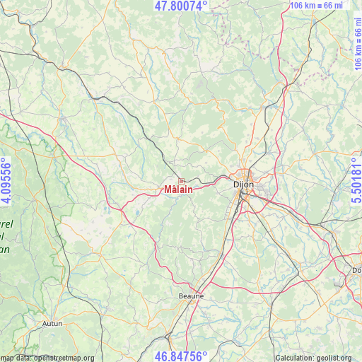
Mâlain GPS coordinates[2]
47° 19' 34.68" North, 4° 47' 55.248" East
| Map corner | latitude | longitude |
|---|---|---|
| Upper-left | 47.80074°, | 4.09556° |
| Center: | 47.3263°, | 4.79868° |
| Lower-right: | 46.84756°, | 5.50181° |
| Map W x H: | 106×106 km | = 65.9×65.9mi |
| max Lat: | 51.07786° ⇑51.1% North |
| Mâlain: | 47.3263° |
| min Lat: | ⇓48.9% South 41.3874° |
| min Long | Mâlain | max Long |
| -5.08615° | 4.79868° | 9.52242° |
| W 75%⇐ | ⇒25% E |
Elevation
Elevation of Mâlain is 344 m = 1129 ft, and this is 150.3 m = 493 ft above average elevation for this country.
| Max E: |
2333 m = 7654 ft | 15.2% |
| Mâlain | 344 m 1129 ft | |
| Avg. | 193.7 m = 635 ft | |
Min E: |
-1 m = -3 ft | 84.8% |
See also: France elevation on elevation.city.
Geographical zone
Mâlain is located in North temperate zone (between Tropic of Cancer and the Arctic Circle). Distance of this North polar circle is 2139 km =1329.1 mi to North.| Distance of | km | miles | from Mâlain |
|---|---|---|---|
| North Pole | 4744.9 | 2948.3 | to North |
| Arctic Circle | 2139 | 1329.1 | to North |
| Tropic Cancer | 2656.3 | 1650.5 | to South |
| Equator | 5262.2 | 3269.8 | to South |


Nearby cities:
15 places around Mâlain: (largest is in red/bold)
• Blaisy-Bas
6.7 km =4.2 mi,  317°
317°
• Brochon
16.1 km =10 mi,  127°
127°
• Chenôve
16 km =9.9 mi,  103°
103°
• Corcelles-les-Monts
11.2 km =7 mi,  108°
108°
• Couchey
15.7 km =9.8 mi,  118°
118°
• Daix
15.5 km =9.6 mi,  79°
79°
• Fixin
16 km =9.9 mi, 124°
• Fleurey-sur-Ouche
4.8 km =3 mi, 109°
• Hauteville-lès-Dijon
15.3 km =9.5 mi,  73°
73°
• Marsannay-la-Côte
15.6 km =9.7 mi, 113°
• Plombières-lès-Dijon
12.7 km =7.9 mi,  86°
86°
• Sainte-Marie-sur-Ouche
4.4 km =2.7 mi,  182°
182°
• Sombernon
6.9 km =4.3 mi,  254°
254°
• Talant
15.9 km =9.9 mi, 85°
• Velars-sur-Ouche
8.1 km =5 mi, 95°
Sources, notices
• [Note1] Compared only with cities in France existing in our database
• [Src1] Map data: © OpenStreetMap contributors (CC-BY-SA)
• [Src2] Other city data from geonames.org with taken over terms of usage.
• [Src3] Geographical zone / Annual Mean Temperature by Robert A. Rohde @ Wikipedia
