Vauvillers geodata
Vauvillers (Bourgogne-Franche-Comté) is a populated place; located in France in Europe/Paris (GMT+2) time zone. With population of 708 people, there are 11684 cities with bigger population in this country. Compared to other cities in France, 57.9% of cities are located further ↓South; 88.1% of cities are located further ←West and 81.4% of cities have lower elevation than Vauvillers. Note1
Administrative division(s):
- Level 1: Bourgogne-Franche-Comté
- Level 2: Département de la Haute-Saône
- Level 3: Arrondissement de Lure
- Level 4: Vauvillers


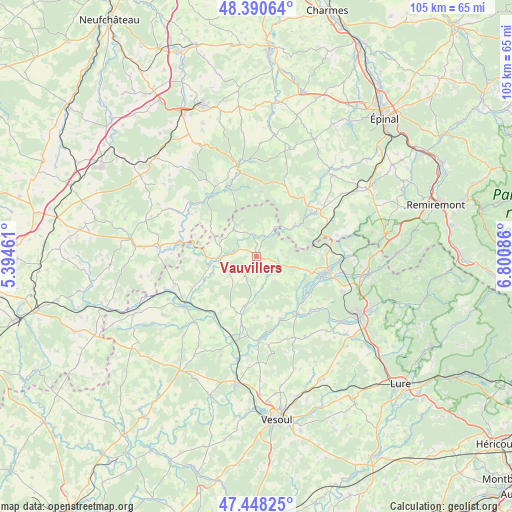
Vauvillers GPS coordinates[2]
47° 55' 17.724" North, 6° 5' 51.828" East
| Map corner | latitude | longitude |
|---|---|---|
| Upper-left | 48.39064°, | 5.39461° |
| Center: | 47.92159°, | 6.09773° |
| Lower-right: | 47.44825°, | 6.80086° |
| Map W x H: | 104.8×104.8 km | = 65.1×65.1mi |
| max Lat: | 51.07786° ⇑42.1% North |
| Vauvillers: | 47.92159° |
| min Lat: | ⇓57.9% South 41.3874° |
| min Long | Vauvillers | max Long |
| -5.08615° | 6.09773° | 9.52242° |
| W 88.1%⇐ | ⇒11.9% E |
Elevation
Elevation of Vauvillers is 304 m = 997 ft, and this is 110.3 m = 362 ft above average elevation for this country.
| Max E: |
2333 m = 7654 ft | 18.6% |
| Vauvillers | 304 m 997 ft | |
| Avg. | 193.7 m = 635 ft | |
Min E: |
-1 m = -3 ft | 81.4% |
See also: France elevation on elevation.city.
Geographical zone
Vauvillers is located in North temperate zone (between Tropic of Cancer and the Arctic Circle). Distance of this North polar circle is 2072.8 km =1288 mi to North.| Distance of | km | miles | from Vauvillers |
|---|---|---|---|
| North Pole | 4678.7 | 2907.2 | to North |
| Arctic Circle | 2072.8 | 1288 | to North |
| Tropic Cancer | 2722.5 | 1691.7 | to South |
| Equator | 5328.4 | 3310.9 | to South |


Nearby cities:
15 places around Vauvillers: (largest is in red/bold)
• Aillevillers-et-Lyaumont
17.9 km =11.1 mi,  90°
90°
• Amance
13.7 km =8.5 mi,  192°
192°
• Bains-les-Bains
15.3 km =9.5 mi,  54°
54°
• Conflans-sur-Lanterne
14.7 km =9.1 mi,  142°
142°
• Corbenay
17.6 km =10.9 mi,  100°
100°
• Corre
7.9 km =4.9 mi,  267°
267°
• Faverney
17.2 km =10.7 mi,  178°
178°
• Fontenoy-le-Château
9.6 km =6 mi, 52°
• Jussey
18.1 km =11.2 mi,  233°
233°
• Le Clerjus
17.5 km =10.9 mi,  75°
75°
• Monthureux-sur-Saône
15.6 km =9.7 mi,  323°
323°
• Passavant-la-Rochère
7 km =4.3 mi, 318°
• Polaincourt-et-Clairefontaine
4.9 km =3 mi,  205°
205°
• Saint-Loup-sur-Semouse
13.9 km =8.6 mi,  107°
107°
• Saint-Remy
9.8 km =6.1 mi, 179°
Sources, notices
• [Note1] Compared only with cities in France existing in our database
• [Src1] Map data: © OpenStreetMap contributors (CC-BY-SA)
• [Src2] Other city data from geonames.org with taken over terms of usage.
• [Src3] Geographical zone / Annual Mean Temperature by Robert A. Rohde @ Wikipedia
