Passavant-la-Rochère geodata
Passavant-la-Rochère (Bourgogne-Franche-Comté) is a populated place; located in France in Europe/Paris (GMT+2) time zone. With population of 822 people, there are 10372 cities with bigger population in this country. Compared to other cities in France, 58.7% of cities are located further ↓South; 87.4% of cities are located further ←West and 77.1% of cities have lower elevation than Passavant-la-Rochère. Note1
Administrative division(s):
- Level 1: Bourgogne-Franche-Comté
- Level 2: Département de la Haute-Saône
- Level 3: Arrondissement de Lure
- Level 4: Passavant-la-Rochère


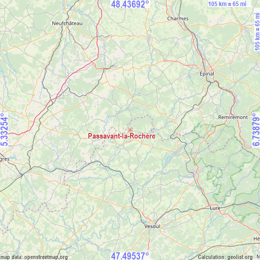
Passavant-la-Rochère GPS coordinates[2]
47° 58' 5.844" North, 6° 2' 8.376" East
| Map corner | latitude | longitude |
|---|---|---|
| Upper-left | 48.43692°, | 5.33254° |
| Center: | 47.96829°, | 6.03566° |
| Lower-right: | 47.49537°, | 6.73879° |
| Map W x H: | 104.7×104.7 km | = 65.1×65.1mi |
| max Lat: | 51.07786° ⇑41.3% North |
| Passavant-la-Rochère: | 47.96829° |
| min Lat: | ⇓58.7% South 41.3874° |
| min Long | Passavant-la-Ro | max Long |
| -5.08615° | 6.03566° | 9.52242° |
| W 87.4%⇐ | ⇒12.6% E |
Elevation
Elevation of Passavant-la-Rochère is 264 m = 866 ft, and this is 70.3 m = 231 ft above average elevation for this country.
| Max E: |
2333 m = 7654 ft | 22.9% |
| Passavant-la-Rochère | 264 m 866 ft | |
| Avg. | 193.7 m = 635 ft | |
Min E: |
-1 m = -3 ft | 77.1% |
See also: France elevation on elevation.city.
Geographical zone
Passavant-la-Rochère is located in North temperate zone (between Tropic of Cancer and the Arctic Circle). Distance of this North polar circle is 2067.6 km =1284.7 mi to North.| Distance of | km | miles | from Passavant-la-Rochère |
|---|---|---|---|
| North Pole | 4673.5 | 2904 | to North |
| Arctic Circle | 2067.6 | 1284.7 | to North |
| Tropic Cancer | 2727.7 | 1694.9 | to South |
| Equator | 5333.6 | 3314.1 | to South |


Nearby cities:
15 places around Passavant-la-Rochère: (largest is in red/bold)
• Amance
18.7 km =11.6 mi,  174°
174°
• Bains-les-Bains
17.4 km =10.8 mi,  77°
77°
• Bourbonne-les-Bains
21.5 km =13.4 mi,  265°
265°
• Conflans-sur-Lanterne
21.6 km =13.4 mi,  141°
141°
• Corre
6.4 km =4 mi,  210°
210°
• Darney
13.2 km =8.2 mi,  4°
4°
• Fontenoy-le-Château
12.2 km =7.6 mi,  87°
87°
• Jussey
18.8 km =11.7 mi, 212°
• Le Clerjus
21.5 km =13.4 mi, 91°
• Martigny-les-Bains
21.9 km =13.6 mi,  313°
313°
• Monthureux-sur-Saône
8.7 km =5.4 mi,  327°
327°
• Polaincourt-et-Clairefontaine
9.9 km =6.2 mi, 165°
• Saint-Loup-sur-Semouse
20.2 km =12.6 mi,  117°
117°
• Saint-Remy
15.8 km =9.8 mi,  162°
162°
• Vauvillers
7 km =4.3 mi, 138°
Sources, notices
• [Note1] Compared only with cities in France existing in our database
• [Src1] Map data: © OpenStreetMap contributors (CC-BY-SA)
• [Src2] Other city data from geonames.org with taken over terms of usage.
• [Src3] Geographical zone / Annual Mean Temperature by Robert A. Rohde @ Wikipedia
