Corre geodata
Corre (Bourgogne-Franche-Comté) is a populated place; located in France in Europe/Paris (GMT+2) time zone. With population of 651 people, there are 12511 cities with bigger population in this country. Compared to other cities in France, 57.9% of cities are located further ↓South; 87% of cities are located further ←West and 71.2% of cities have lower elevation than Corre. Note1
Administrative division(s):
- Level 1: Bourgogne-Franche-Comté
- Level 2: Département de la Haute-Saône
- Level 3: Arrondissement de Vesoul
- Level 4: Corre


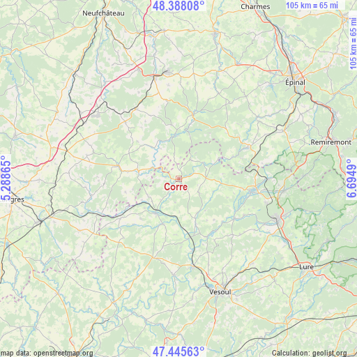
Corre GPS coordinates[2]
47° 55' 8.4" North, 5° 59' 30.372" East
| Map corner | latitude | longitude |
|---|---|---|
| Upper-left | 48.38808°, | 5.28865° |
| Center: | 47.919°, | 5.99177° |
| Lower-right: | 47.44563°, | 6.6949° |
| Map W x H: | 104.8×104.8 km | = 65.1×65.1mi |
| max Lat: | 51.07786° ⇑42.1% North |
| Corre: | 47.919° |
| min Lat: | ⇓57.9% South 41.3874° |
| min Long | Corre | max Long |
| -5.08615° | 5.99177° | 9.52242° |
| W 87%⇐ | ⇒13% E |
Elevation
Elevation of Corre is 225 m = 738 ft, and this is 31.3 m = 103 ft above average elevation for this country.
| Max E: |
2333 m = 7654 ft | 28.8% |
| Corre | 225 m 738 ft | |
| Avg. | 193.7 m = 635 ft | |
Min E: |
-1 m = -3 ft | 71.2% |
See also: France elevation on elevation.city.
Geographical zone
Corre is located in North temperate zone (between Tropic of Cancer and the Arctic Circle). Distance of this North polar circle is 2073.1 km =1288.2 mi to North.| Distance of | km | miles | from Corre |
|---|---|---|---|
| North Pole | 4679 | 2907.4 | to North |
| Arctic Circle | 2073.1 | 1288.2 | to North |
| Tropic Cancer | 2722.2 | 1691.5 | to South |
| Equator | 5328.1 | 3310.7 | to South |


Nearby cities:
15 places around Corre: (largest is in red/bold)
• Amance
14.1 km =8.8 mi,  159°
159°
• Bains-les-Bains
22.3 km =13.9 mi,  65°
65°
• Bourbonne-les-Bains
18.5 km =11.5 mi,  281°
281°
• Breurey-lès-Faverney
20.9 km =13 mi,  150°
150°
• Conflans-sur-Lanterne
20.3 km =12.6 mi,  124°
124°
• Darney
19.1 km =11.9 mi,  12°
12°
• Faverney
18.9 km =11.7 mi, 153°
• Fontenoy-le-Château
16.6 km =10.3 mi, 68°
• Jussey
12.4 km =7.7 mi,  212°
212°
• Monthureux-sur-Saône
12.9 km =8 mi,  353°
353°
• Passavant-la-Rochère
6.4 km =4 mi,  30°
30°
• Polaincourt-et-Clairefontaine
7.1 km =4.4 mi,  125°
125°
• Saint-Loup-sur-Semouse
21.5 km =13.4 mi,  100°
100°
• Saint-Remy
12.5 km =7.8 mi,  139°
139°
• Vauvillers
7.9 km =4.9 mi,  87°
87°
Sources, notices
• [Note1] Compared only with cities in France existing in our database
• [Src1] Map data: © OpenStreetMap contributors (CC-BY-SA)
• [Src2] Other city data from geonames.org with taken over terms of usage.
• [Src3] Geographical zone / Annual Mean Temperature by Robert A. Rohde @ Wikipedia
