Fontenoy-le-Château geodata
Fontenoy-le-Château (Grand Est) is a populated place; located in France in Europe/Paris (GMT+2) time zone. With population of 722 people, there are 11512 cities with bigger population in this country. Compared to other cities in France, 58.8% of cities are located further ↓South; 89.3% of cities are located further ←West and 78.5% of cities have lower elevation than Fontenoy-le-Château. Note1
Administrative division(s):
- Level 1: Grand Est
- Level 2: Vosges
- Level 3: Arrondissement d’Épinal
- Level 4: Fontenoy-le-Château


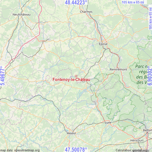
Fontenoy-le-Château GPS coordinates[2]
47° 58' 25.14" North, 6° 11' 59.604" East
| Map corner | latitude | longitude |
|---|---|---|
| Upper-left | 48.44223°, | 5.49677° |
| Center: | 47.97365°, | 6.19989° |
| Lower-right: | 47.50078°, | 6.90302° |
| Map W x H: | 104.7×104.7 km | = 65.1×65.1mi |
| max Lat: | 51.07786° ⇑41.2% North |
| Fontenoy-le-Château: | 47.97365° |
| min Lat: | ⇓58.8% South 41.3874° |
| min Long | Fontenoy-le-Ch� | max Long |
| -5.08615° | 6.19989° | 9.52242° |
| W 89.3%⇐ | ⇒10.7% E |
Elevation
Elevation of Fontenoy-le-Château is 276 m = 906 ft, and this is 82.3 m = 270 ft above average elevation for this country.
| Max E: |
2333 m = 7654 ft | 21.5% |
| Fontenoy-le-Château | 276 m 906 ft | |
| Avg. | 193.7 m = 635 ft | |
Min E: |
-1 m = -3 ft | 78.5% |
See also: France elevation on elevation.city.
Geographical zone
Fontenoy-le-Château is located in North temperate zone (between Tropic of Cancer and the Arctic Circle). Distance of this North polar circle is 2067 km =1284.4 mi to North.| Distance of | km | miles | from Fontenoy-le-Château |
|---|---|---|---|
| North Pole | 4672.9 | 2903.6 | to North |
| Arctic Circle | 2067 | 1284.4 | to North |
| Tropic Cancer | 2728.3 | 1695.3 | to South |
| Equator | 5334.2 | 3314.5 | to South |


Nearby cities:
15 places around Fontenoy-le-Château: (largest is in red/bold)
• Aillevillers-et-Lyaumont
11.9 km =7.4 mi,  120°
120°
• Bains-les-Bains
5.7 km =3.5 mi,  57°
57°
• Corbenay
13.2 km =8.2 mi,  132°
132°
• Corre
16.6 km =10.3 mi,  248°
248°
• Darney
16.8 km =10.4 mi,  318°
318°
• Fontaine-lès-Luxeuil
16.5 km =10.3 mi,  142°
142°
• La Chapelle-aux-Bois
12.2 km =7.6 mi,  54°
54°
• Le Clerjus
9.3 km =5.8 mi,  97°
97°
• Passavant-la-Rochère
12.2 km =7.6 mi,  267°
267°
• Polaincourt-et-Clairefontaine
14.1 km =8.8 mi,  223°
223°
• Saint-Loup-sur-Semouse
11.5 km =7.1 mi,  150°
150°
• Saint-Remy
17.3 km =10.7 mi,  205°
205°
• Uzemain
16.5 km =10.3 mi,  40°
40°
• Vauvillers
9.6 km =6 mi,  232°
232°
• Xertigny
17.4 km =10.8 mi, 63°
Sources, notices
• [Note1] Compared only with cities in France existing in our database
• [Src1] Map data: © OpenStreetMap contributors (CC-BY-SA)
• [Src2] Other city data from geonames.org with taken over terms of usage.
• [Src3] Geographical zone / Annual Mean Temperature by Robert A. Rohde @ Wikipedia
