Saint-Remy geodata
Saint-Remy (Bourgogne-Franche-Comté) is a populated place; located in France in Europe/Paris (GMT+2) time zone. With population of 811 people, there are 10468 cities with bigger population in this country. Compared to other cities in France, 56.3% of cities are located further ↓South; 88.2% of cities are located further ←West and 79.2% of cities have lower elevation than Saint-Remy. Note1
Administrative division(s):
- Level 1: Bourgogne-Franche-Comté
- Level 2: Département de la Haute-Saône
- Level 3: Arrondissement de Vesoul
- Level 4: Saint-Rémy-en-Comté


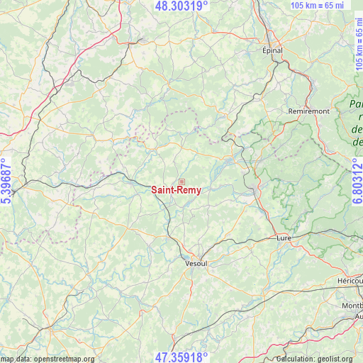
Saint-Remy GPS coordinates[2]
47° 49' 59.988" North, 6° 6' 0" East
| Map corner | latitude | longitude |
|---|---|---|
| Upper-left | 48.30319°, | 5.39687° |
| Center: | 47.83333°, | 6.1° |
| Lower-right: | 47.35918°, | 6.80312° |
| Map W x H: | 105×105 km | = 65.2×65.2mi |
| max Lat: | 51.07786° ⇑43.7% North |
| Saint-Remy: | 47.83333° |
| min Lat: | ⇓56.3% South 41.3874° |
| min Long | Saint-Remy | max Long |
| -5.08615° | 6.1° | 9.52242° |
| W 88.2%⇐ | ⇒11.8% E |
Elevation
Elevation of Saint-Remy is 282 m = 925 ft, and this is 88.3 m = 290 ft above average elevation for this country.
| Max E: |
2333 m = 7654 ft | 20.8% |
| Saint-Remy | 282 m 925 ft | |
| Avg. | 193.7 m = 635 ft | |
Min E: |
-1 m = -3 ft | 79.2% |
See also: France elevation on elevation.city.
Geographical zone
Saint-Remy is located in North temperate zone (between Tropic of Cancer and the Arctic Circle). Distance of this North polar circle is 2082.6 km =1294.1 mi to North.| Distance of | km | miles | from Saint-Remy |
|---|---|---|---|
| North Pole | 4688.5 | 2913.3 | to North |
| Arctic Circle | 2082.6 | 1294.1 | to North |
| Tropic Cancer | 2712.6 | 1685.5 | to South |
| Equator | 5318.6 | 3304.8 | to South |


Nearby cities:
15 places around Saint-Remy: (largest is in red/bold)
• Amance
4.7 km =2.9 mi,  220°
220°
• Breuches
17.5 km =10.9 mi,  102°
102°
• Breurey-lès-Faverney
9 km =5.6 mi,  164°
164°
• Conflans-sur-Lanterne
8.9 km =5.5 mi, 102°
• Corbenay
18.4 km =11.4 mi,  68°
68°
• Corre
12.5 km =7.8 mi,  319°
319°
• Faverney
7.4 km =4.6 mi,  177°
177°
• Fontaine-lès-Luxeuil
17.7 km =11 mi,  81°
81°
• Fontenoy-le-Château
17.3 km =10.7 mi,  25°
25°
• Jussey
14.8 km =9.2 mi,  266°
266°
• Passavant-la-Rochère
15.8 km =9.8 mi,  342°
342°
• Polaincourt-et-Clairefontaine
5.9 km =3.7 mi, 337°
• Port-sur-Saône
16.6 km =10.3 mi,  192°
192°
• Saint-Loup-sur-Semouse
14.2 km =8.8 mi, 66°
• Vauvillers
9.8 km =6.1 mi,  359°
359°
Sources, notices
• [Note1] Compared only with cities in France existing in our database
• [Src1] Map data: © OpenStreetMap contributors (CC-BY-SA)
• [Src2] Other city data from geonames.org with taken over terms of usage.
• [Src3] Geographical zone / Annual Mean Temperature by Robert A. Rohde @ Wikipedia
