Vauchelles-les-Quesnoy geodata
Vauchelles-les-Quesnoy (Hauts-de-France) is a populated place; located in France in Europe/Paris (GMT+2) time zone. With population of 855 people, there are 10032 cities with bigger population in this country. Compared to other cities in France, 94.2% of cities are located further ↓South; 58.4% of cities are located further →East and 77.3% of cities have higher elevation than Vauchelles-les-Quesnoy. Note1
Administrative division(s):
- Level 1: Hauts-de-France
- Level 2: Somme
- Level 3: Abbeville
- Level 4: Vauchelles-les-Quesnoy
Current local time in Vauchelles-les-Quesnoy:
03:27 AM, SaturdayDifference from your time zone: hours


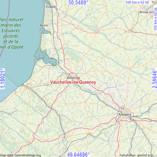
Vauchelles-les-Quesnoy GPS coordinates[2]
50° 6' 0" North, 1° 52' 59.988" East
| Map corner | latitude | longitude |
|---|---|---|
| Upper-left | 50.5489°, | 1.18021° |
| Center: | 50.1°, | 1.88333° |
| Lower-right: | 49.64686°, | 2.58646° |
| Map W x H: | 100.3×100.3 km | = 62.3×62.3mi |
| max Lat: | 51.07786° ⇑5.8% North |
| Vauchelles-les-Quesnoy: | 50.1° |
| min Lat: | ⇓94.2% South 41.3874° |
| min Long | Vauchelles-les- | max Long |
| -5.08615° | 1.88333° | 9.52242° |
| W 41.6%⇐ | ⇒58.4% E |
Elevation
Elevation of Vauchelles-les-Quesnoy is 61 m = 200 ft, and this is 132.7 m = 435 ft below average elevation for this country.
| Max E: |
2333 m = 7654 ft | 77.3% |
| Avg. | 193.7 m = 635 ft | |
| Vauchelles-les-Quesnoy | 61 m = 200 ft | |
Min E: |
-1 m = -3 ft | 22.7% |
See also: France elevation on elevation.city.
Geographical zone
Vauchelles-les-Quesnoy is located in North temperate zone (between Tropic of Cancer and the Arctic Circle). Distance of this North polar circle is 1830.6 km =1137.5 mi to North.| Distance of | km | miles | from Vauchelles-les-Quesnoy |
|---|---|---|---|
| North Pole | 4436.5 | 2756.7 | to North |
| Arctic Circle | 1830.6 | 1137.5 | to North |
| Tropic Cancer | 2964.7 | 1842.2 | to South |
| Equator | 5570.6 | 3461.4 | to South |


Nearby cities:
15 places around Vauchelles-les-Quesnoy: (largest is in red/bold)
• Abbeville
3.5 km =2.2 mi,  279°
279°
• Ailly-le-Haut-Clocher
8.2 km =5.1 mi,  106°
106°
• Buigny-Saint-Maclou
7.9 km =4.9 mi,  320°
320°
• Cambron
8.2 km =5.1 mi, 278°
• Caours
3.3 km =2.1 mi,  4°
4°
• Drucat
5 km =3.1 mi,  350°
350°
• Huchenneville
8.1 km =5 mi,  227°
227°
• Huppy
11.9 km =7.4 mi, 225°
• Long
9.5 km =5.9 mi,  133°
133°
• Mareuil-Caubert
5.2 km =3.2 mi, 226°
• Miannay
11.8 km =7.3 mi,  268°
268°
• Moyenneville
10 km =6.2 mi,  251°
251°
• Pont-Remy
6 km =3.7 mi,  156°
156°
• Saint-Riquier
5.8 km =3.6 mi,  51°
51°
• Épagne-Épagnette
3.2 km =2 mi,  192°
192°
Sources, notices
• [Note1] Compared only with cities in France existing in our database
• [Src1] Map data: © OpenStreetMap contributors (CC-BY-SA)
• [Src2] Other city data from geonames.org with taken over terms of usage.
• [Src3] Geographical zone / Annual Mean Temperature by Robert A. Rohde @ Wikipedia
