Long geodata
Long (Hauts-de-France) is a populated place; located in France in Europe/Paris (GMT+2) time zone. With population of 636 people, there are 12726 cities with bigger population in this country. Compared to other cities in France, 93.8% of cities are located further ↓South; 57.4% of cities are located further →East and 86.7% of cities have higher elevation than Long. Note1
Administrative division(s):
- Level 1: Hauts-de-France
- Level 2: Somme
- Level 3: Abbeville
- Level 4: Long


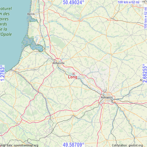
Long GPS coordinates[2]
50° 2' 26.844" North, 1° 58' 45.912" East
| Map corner | latitude | longitude |
|---|---|---|
| Upper-left | 50.49024°, | 1.2763° |
| Center: | 50.04079°, | 1.97942° |
| Lower-right: | 49.58709°, | 2.68255° |
| Map W x H: | 100.4×100.4 km | = 62.4×62.4mi |
| max Lat: | 51.07786° ⇑6.2% North |
| Long: | 50.04079° |
| min Lat: | ⇓93.8% South 41.3874° |
| min Long | Long | max Long |
| -5.08615° | 1.97942° | 9.52242° |
| W 42.6%⇐ | ⇒57.4% E |
Elevation
Elevation of Long is 38 m = 125 ft, and this is 155.7 m = 511 ft below average elevation for this country.
| Max E: |
2333 m = 7654 ft | 86.7% |
| Avg. | 193.7 m = 635 ft | |
| Long | 38 m = 125 ft | |
Min E: |
-1 m = -3 ft | 13.3% |
See also: France elevation on elevation.city.
Geographical zone
Long is located in North temperate zone (between Tropic of Cancer and the Arctic Circle). Distance of this North polar circle is 1837.2 km =1141.6 mi to North.| Distance of | km | miles | from Long |
|---|---|---|---|
| North Pole | 4443 | 2760.8 | to North |
| Arctic Circle | 1837.2 | 1141.6 | to North |
| Tropic Cancer | 2958.1 | 1838.1 | to South |
| Equator | 5564 | 3457.3 | to South |


Nearby cities:
15 places around Long: (largest is in red/bold)
• Ailly-le-Haut-Clocher
4.4 km =2.7 mi,  14°
14°
• Airaines
8.5 km =5.3 mi,  198°
198°
• Allery
10.3 km =6.4 mi,  214°
214°
• Condé-Folie
4.2 km =2.6 mi,  146°
146°
• Domart-en-Ponthieu
11.1 km =6.9 mi,  70°
70°
• Flixecourt
7.8 km =4.8 mi,  111°
111°
• Hallencourt
9.1 km =5.7 mi,  233°
233°
• Hangest-sur-Somme
9 km =5.6 mi,  137°
137°
• Longpré-les-Corps-Saints
3.3 km =2.1 mi,  163°
163°
• Mareuil-Caubert
11.1 km =6.9 mi,  286°
286°
• Pont-Remy
4.6 km =2.9 mi,  282°
282°
• Saint-Ouen
10.1 km =6.3 mi,  91°
91°
• Saint-Riquier
10.4 km =6.5 mi,  347°
347°
• Vauchelles-les-Quesnoy
9.5 km =5.9 mi,  313°
313°
• Épagne-Épagnette
8.3 km =5.2 mi, 294°
Sources, notices
• [Note1] Compared only with cities in France existing in our database
• [Src1] Map data: © OpenStreetMap contributors (CC-BY-SA)
• [Src2] Other city data from geonames.org with taken over terms of usage.
• [Src3] Geographical zone / Annual Mean Temperature by Robert A. Rohde @ Wikipedia
