Usson-du-Poitou geodata
Usson-du-Poitou (Nouvelle-Aquitaine) is a populated place; located in France in Europe/Paris (GMT+2) time zone. With population of 1,456 people, there are 6345 cities with bigger population in this country. Compared to other cities in France, 62.6% of cities are located further ↑North; 73.2% of cities are located further →East and 50.6% of cities have lower elevation than Usson-du-Poitou. Note1
Administrative division(s):
- Level 1: Nouvelle-Aquitaine
- Level 2: Vienne
- Level 3: Arrondissement de Montmorillon
- Level 4: Usson-du-Poitou


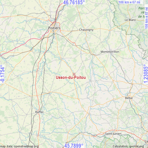
Usson-du-Poitou GPS coordinates[2]
46° 16' 40.908" North, 0° 31' 39.828" East
| Map corner | latitude | longitude |
|---|---|---|
| Upper-left | 46.76185°, | -0.1754° |
| Center: | 46.27803°, | 0.52773° |
| Lower-right: | 45.7899°, | 1.23085° |
| Map W x H: | 108.1×108.1 km | = 67.2×67.2mi |
| max Lat: | 51.07786° ⇑62.6% North |
| Usson-du-Poitou: | 46.27803° |
| min Lat: | ⇓37.4% South 41.3874° |
| min Long | Usson-du-Poitou | max Long |
| -5.08615° | 0.52773° | 9.52242° |
| W 26.8%⇐ | ⇒73.2% E |
Elevation
Elevation of Usson-du-Poitou is 134 m = 440 ft, and this is 59.7 m = 196 ft below average elevation for this country.
| Max E: |
2333 m = 7654 ft | 49.4% |
| Avg. | 193.7 m = 635 ft | |
| Usson-du-Poitou | 134 m = 440 ft | |
Min E: |
-1 m = -3 ft | 50.6% |
See also: France elevation on elevation.city.
Geographical zone
Usson-du-Poitou is located in North temperate zone (between Tropic of Cancer and the Arctic Circle). Distance of this North polar circle is 2255.5 km =1401.5 mi to North.| Distance of | km | miles | from Usson-du-Poitou |
|---|---|---|---|
| North Pole | 4861.4 | 3020.7 | to North |
| Arctic Circle | 2255.5 | 1401.5 | to North |
| Tropic Cancer | 2539.7 | 1578.1 | to South |
| Equator | 5145.6 | 3197.3 | to South |


Nearby cities:
15 places around Usson-du-Poitou: (largest is in red/bold)
• Bouresse
11.3 km =7 mi,  32°
32°
• Château-Garnier
8.2 km =5.1 mi,  254°
254°
• Gouex
15.9 km =9.9 mi,  51°
51°
• Le Vigeant
11.1 km =6.9 mi,  122°
122°
• Magné
13.5 km =8.4 mi,  310°
310°
• Mauprévoir
11.7 km =7.3 mi,  183°
183°
• Millac
15.7 km =9.8 mi,  128°
128°
• Moussac
12.3 km =7.6 mi,  88°
88°
• Payroux
7.9 km =4.9 mi,  205°
205°
• Persac
15.6 km =9.7 mi,  61°
61°
• Queaux
12 km =7.5 mi, 62°
• Saint-Maurice-la-Clouère
14.4 km =8.9 mi,  321°
321°
• Saint-Secondin
6.2 km =3.9 mi,  334°
334°
• Sommières-du-Clain
13 km =8.1 mi,  270°
270°
• Verrières
15.7 km =9.8 mi,  18°
18°
Sources, notices
• [Note1] Compared only with cities in France existing in our database
• [Src1] Map data: © OpenStreetMap contributors (CC-BY-SA)
• [Src2] Other city data from geonames.org with taken over terms of usage.
• [Src3] Geographical zone / Annual Mean Temperature by Robert A. Rohde @ Wikipedia
