Persac geodata
Persac (Nouvelle-Aquitaine) is a populated place; located in France in Europe/Paris (GMT+2) time zone. With population of 933 people, there are 9360 cities with bigger population in this country. Compared to other cities in France, 61.7% of cities are located further ↑North; 71.3% of cities are located further →East and 52.6% of cities have higher elevation than Persac. Note1
Administrative division(s):
- Level 1: Nouvelle-Aquitaine
- Level 2: Vienne
- Level 3: Arrondissement de Montmorillon
- Level 4: Persac


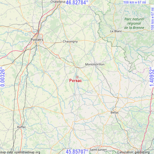
Persac GPS coordinates[2]
46° 20' 40.596" North, 0° 42' 23.004" East
| Map corner | latitude | longitude |
|---|---|---|
| Upper-left | 46.82784°, | 0.00326° |
| Center: | 46.34461°, | 0.70639° |
| Lower-right: | 45.85707°, | 1.40952° |
| Map W x H: | 107.9×107.9 km | = 67×67mi |
| max Lat: | 51.07786° ⇑61.7% North |
| Persac: | 46.34461° |
| min Lat: | ⇓38.3% South 41.3874° |
| min Long | Persac | max Long |
| -5.08615° | 0.70639° | 9.52242° |
| W 28.7%⇐ | ⇒71.3% E |
Elevation
Elevation of Persac is 123 m = 404 ft, and this is 70.7 m = 232 ft below average elevation for this country.
| Max E: |
2333 m = 7654 ft | 52.6% |
| Avg. | 193.7 m = 635 ft | |
| Persac | 123 m = 404 ft | |
Min E: |
-1 m = -3 ft | 47.4% |
See also: France elevation on elevation.city.
Geographical zone
Persac is located in North temperate zone (between Tropic of Cancer and the Arctic Circle). Distance of this North polar circle is 2248.1 km =1396.9 mi to North.| Distance of | km | miles | from Persac |
|---|---|---|---|
| North Pole | 4854 | 3016.1 | to North |
| Arctic Circle | 2248.1 | 1396.9 | to North |
| Tropic Cancer | 2547.1 | 1582.7 | to South |
| Equator | 5153 | 3201.9 | to South |


Nearby cities:
15 places around Persac: (largest is in red/bold)
• Adriers
12.1 km =7.5 mi,  143°
143°
• Bouresse
7.9 km =4.9 mi,  285°
285°
• Civaux
11.5 km =7.1 mi,  344°
344°
• Gouex
2.7 km =1.7 mi,  333°
333°
• Le Vigeant
14 km =8.7 mi,  197°
197°
• Lhommaizé
13.1 km =8.1 mi,  320°
320°
• Lussac-les-Châteaux
6.7 km =4.2 mi,  11°
11°
• Mazerolles
7 km =4.3 mi,  345°
345°
• Montmorillon
15.5 km =9.6 mi,  53°
53°
• Moussac
7.3 km =4.5 mi,  191°
191°
• Queaux
3.6 km =2.2 mi,  237°
237°
• Saulgé
13.5 km =8.4 mi,  74°
74°
• Sillars
9.6 km =6 mi,  29°
29°
• Usson-du-Poitou
15.6 km =9.7 mi, 241°
• Verrières
11.6 km =7.2 mi,  310°
310°
Sources, notices
• [Note1] Compared only with cities in France existing in our database
• [Src1] Map data: © OpenStreetMap contributors (CC-BY-SA)
• [Src2] Other city data from geonames.org with taken over terms of usage.
• [Src3] Geographical zone / Annual Mean Temperature by Robert A. Rohde @ Wikipedia
