Ungersheim geodata
Ungersheim (Grand Est) is a populated place; located in France in Europe/Paris (GMT+2) time zone. With population of 1,705 people, there are 5507 cities with bigger population in this country. Compared to other cities in France, 57.2% of cities are located further ↓South; 96.6% of cities are located further ←West and 69.2% of cities have lower elevation than Ungersheim. Note1
Administrative division(s):
- Level 1: Grand Est
- Level 2: Haut-Rhin
- Level 3: Arrondissement de Mulhouse
- Level 4: Ungersheim


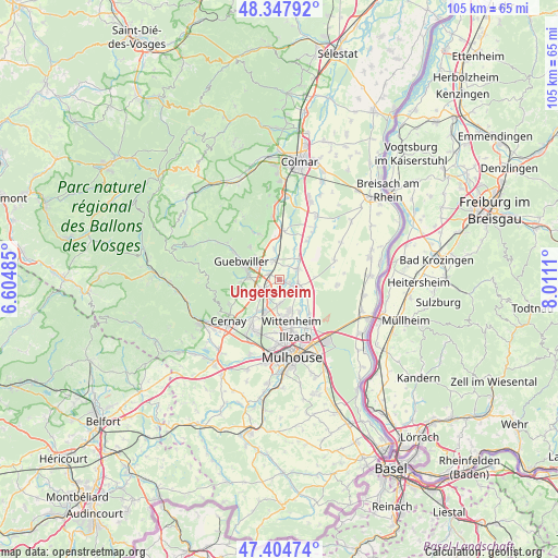
Ungersheim GPS coordinates[2]
47° 52' 42.528" North, 7° 18' 28.692" East
| Map corner | latitude | longitude |
|---|---|---|
| Upper-left | 48.34792°, | 6.60485° |
| Center: | 47.87848°, | 7.30797° |
| Lower-right: | 47.40474°, | 8.0111° |
| Map W x H: | 104.9×104.9 km | = 65.2×65.2mi |
| max Lat: | 51.07786° ⇑42.8% North |
| Ungersheim: | 47.87848° |
| min Lat: | ⇓57.2% South 41.3874° |
| min Long | Ungersheim | max Long |
| -5.08615° | 7.30797° | 9.52242° |
| W 96.6%⇐ | ⇒3.4% E |
Elevation
Elevation of Ungersheim is 215 m = 705 ft, and this is 21.3 m = 70 ft above average elevation for this country.
| Max E: |
2333 m = 7654 ft | 30.8% |
| Ungersheim | 215 m 705 ft | |
| Avg. | 193.7 m = 635 ft | |
Min E: |
-1 m = -3 ft | 69.2% |
See also: France elevation on elevation.city.
Geographical zone
Ungersheim is located in North temperate zone (between Tropic of Cancer and the Arctic Circle). Distance of this North polar circle is 2077.6 km =1291 mi to North.| Distance of | km | miles | from Ungersheim |
|---|---|---|---|
| North Pole | 4683.5 | 2910.2 | to North |
| Arctic Circle | 2077.6 | 1291 | to North |
| Tropic Cancer | 2717.7 | 1688.7 | to South |
| Equator | 5323.6 | 3307.9 | to South |


Nearby cities:
15 places around Ungersheim: (largest is in red/bold)
• Bergholtz
6.2 km =3.9 mi,  312°
312°
• Bollwiller
4.1 km =2.5 mi,  236°
236°
• Ensisheim
3.5 km =2.2 mi,  113°
113°
• Feldkirch
2.9 km =1.8 mi, 238°
• Gundolsheim
5.8 km =3.6 mi,  350°
350°
• Hartmannswiller
7.1 km =4.4 mi,  254°
254°
• Issenheim
5 km =3.1 mi,  303°
303°
• Merxheim
3.8 km =2.4 mi, 345°
• Meyenheim
5.3 km =3.3 mi,  42°
42°
• Pulversheim
4.6 km =2.9 mi,  186°
186°
• Raedersheim
2.2 km =1.4 mi, 301°
• Ruelisheim
7.1 km =4.4 mi,  148°
148°
• Réguisheim
3.9 km =2.4 mi,  60°
60°
• Soultz-Haut-Rhin
6 km =3.7 mi,  280°
280°
• Staffelfelden
7.1 km =4.4 mi,  215°
215°
Sources, notices
• [Note1] Compared only with cities in France existing in our database
• [Src1] Map data: © OpenStreetMap contributors (CC-BY-SA)
• [Src2] Other city data from geonames.org with taken over terms of usage.
• [Src3] Geographical zone / Annual Mean Temperature by Robert A. Rohde @ Wikipedia
